Before & After NYC
Photo project from NYC Grid
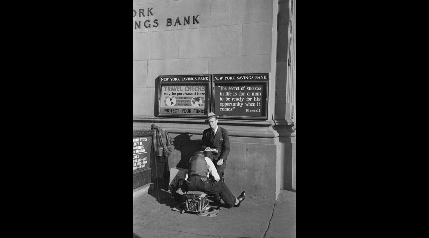
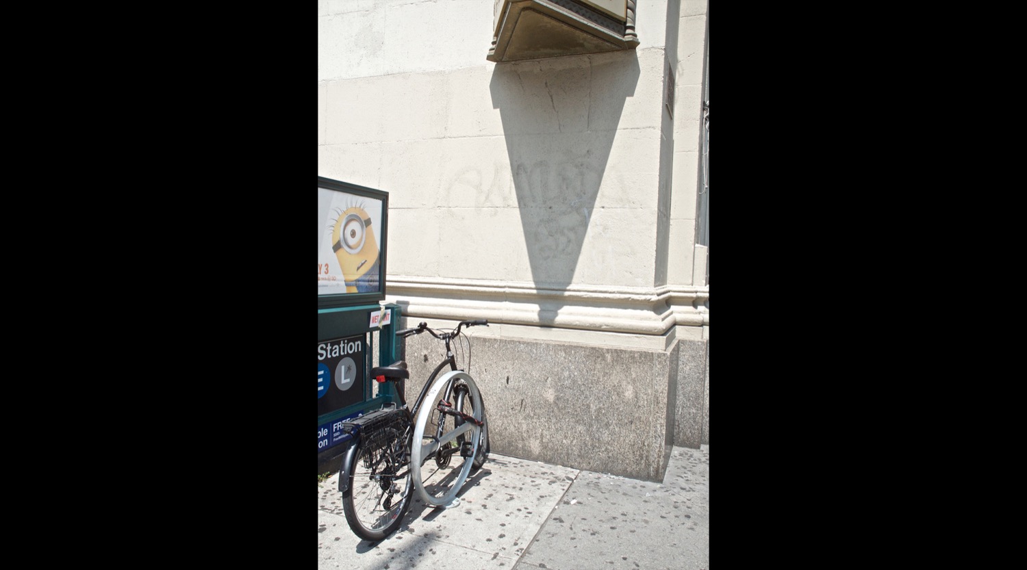
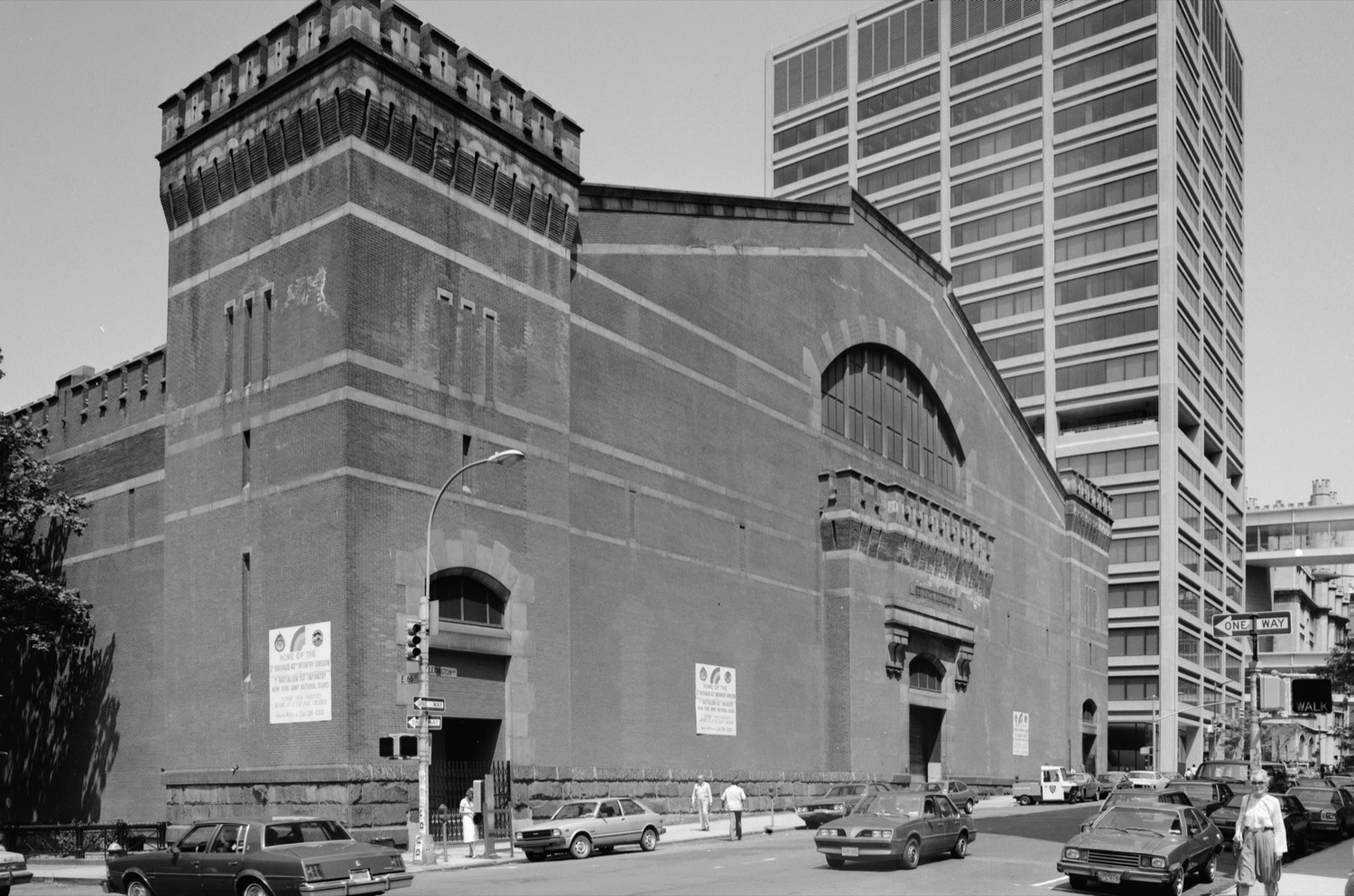
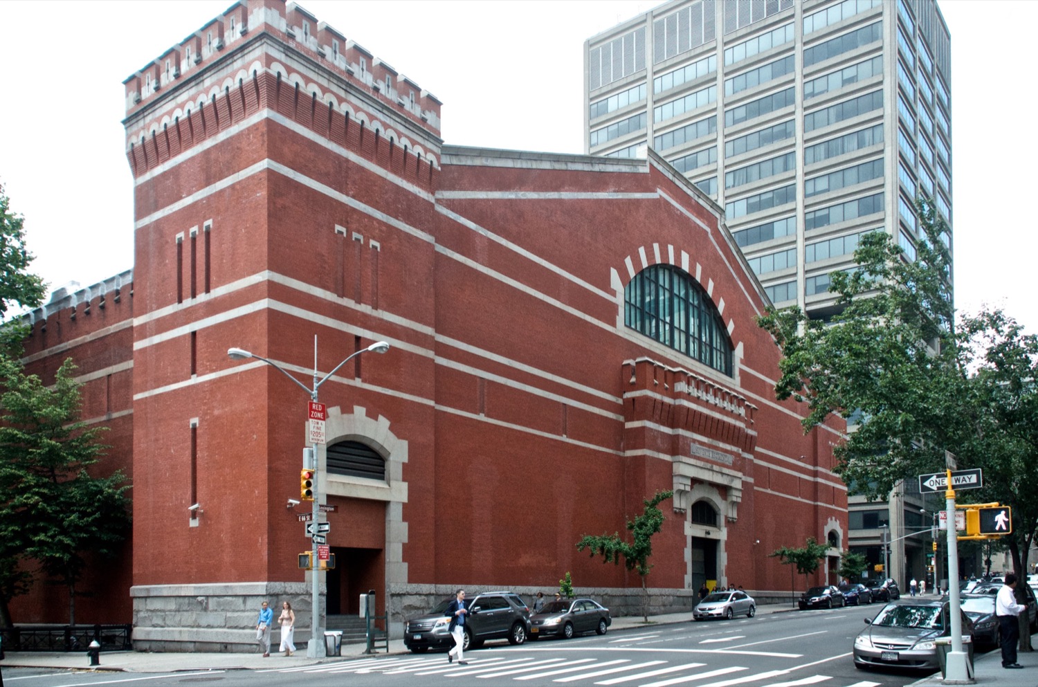
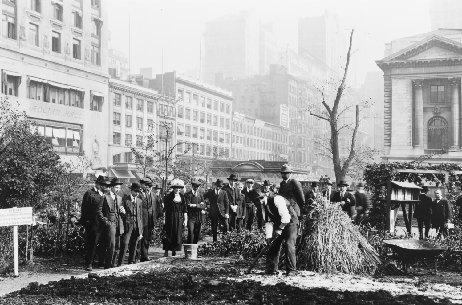
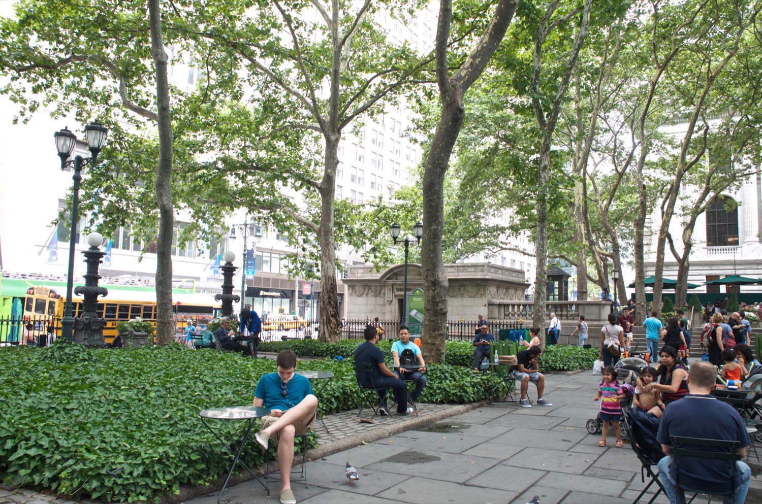
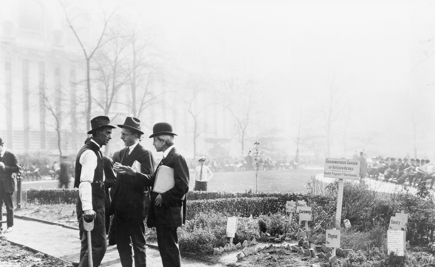
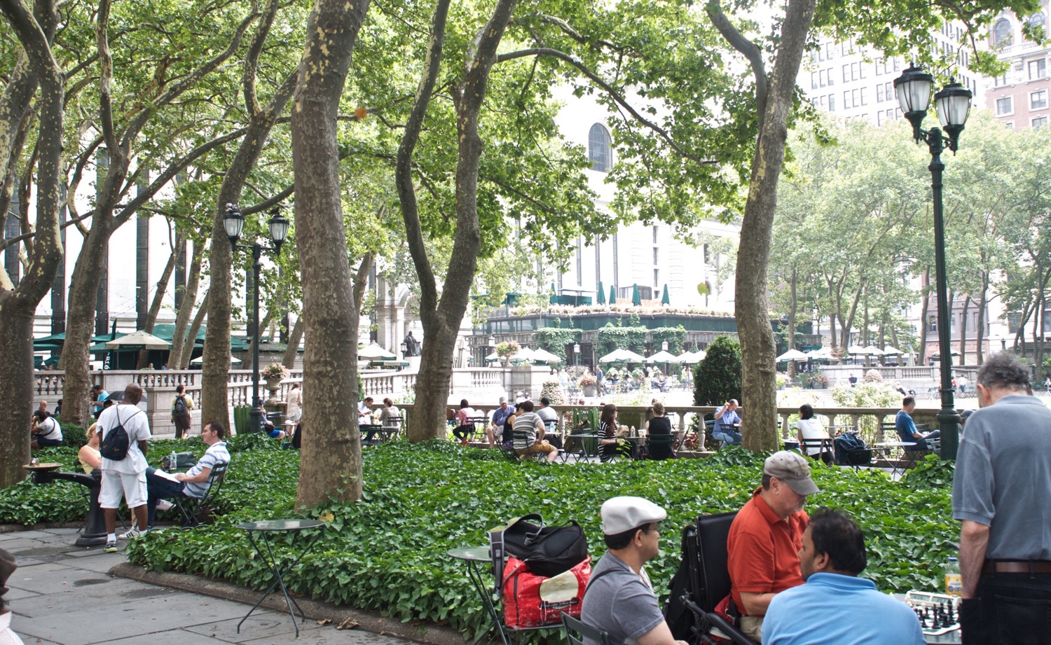
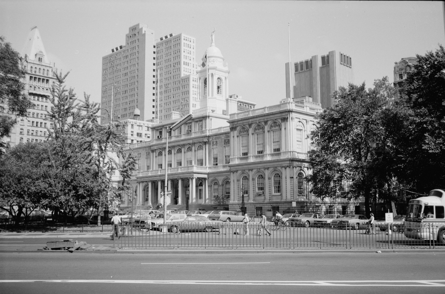
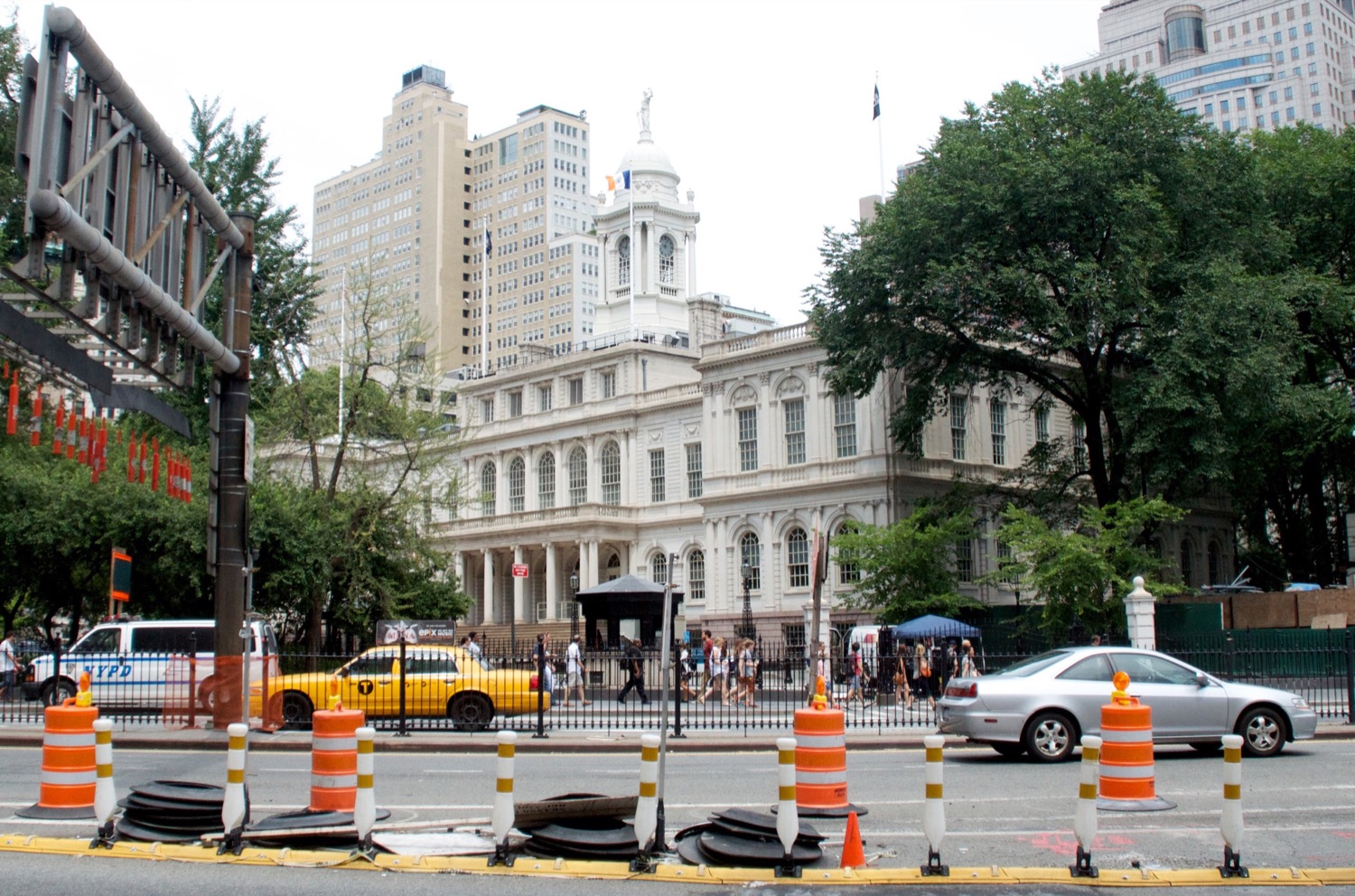
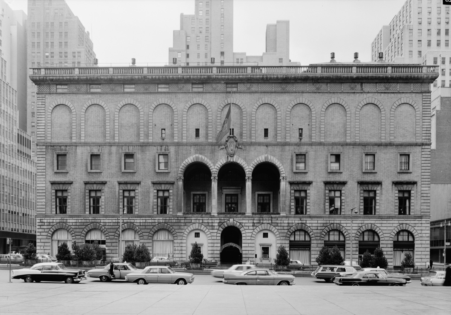
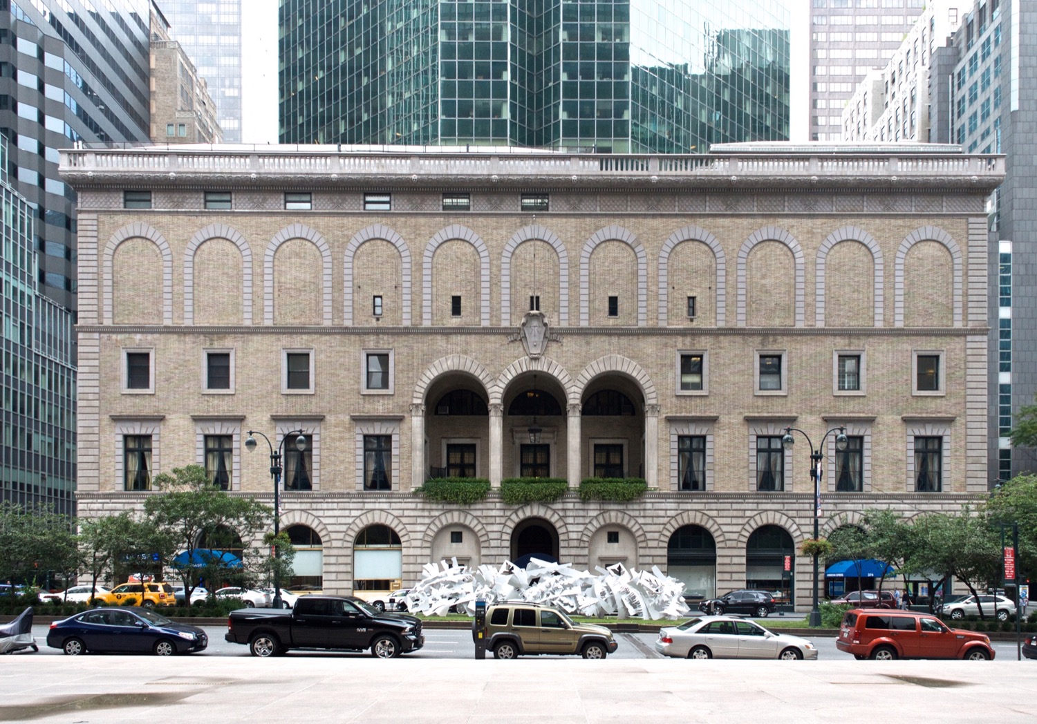
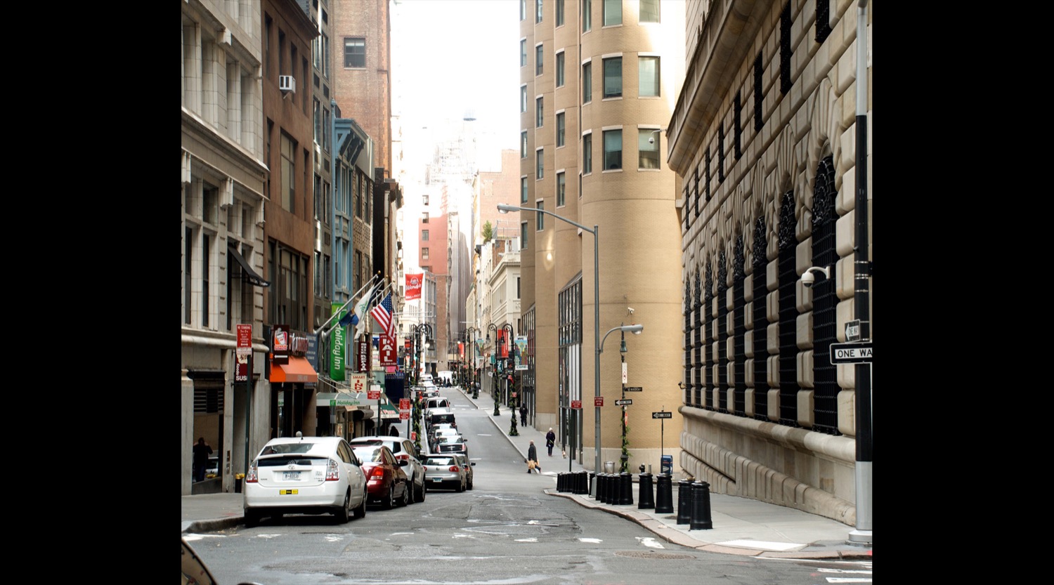
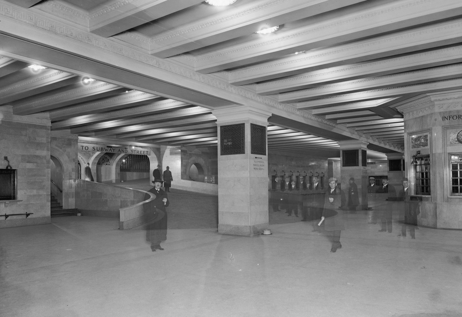
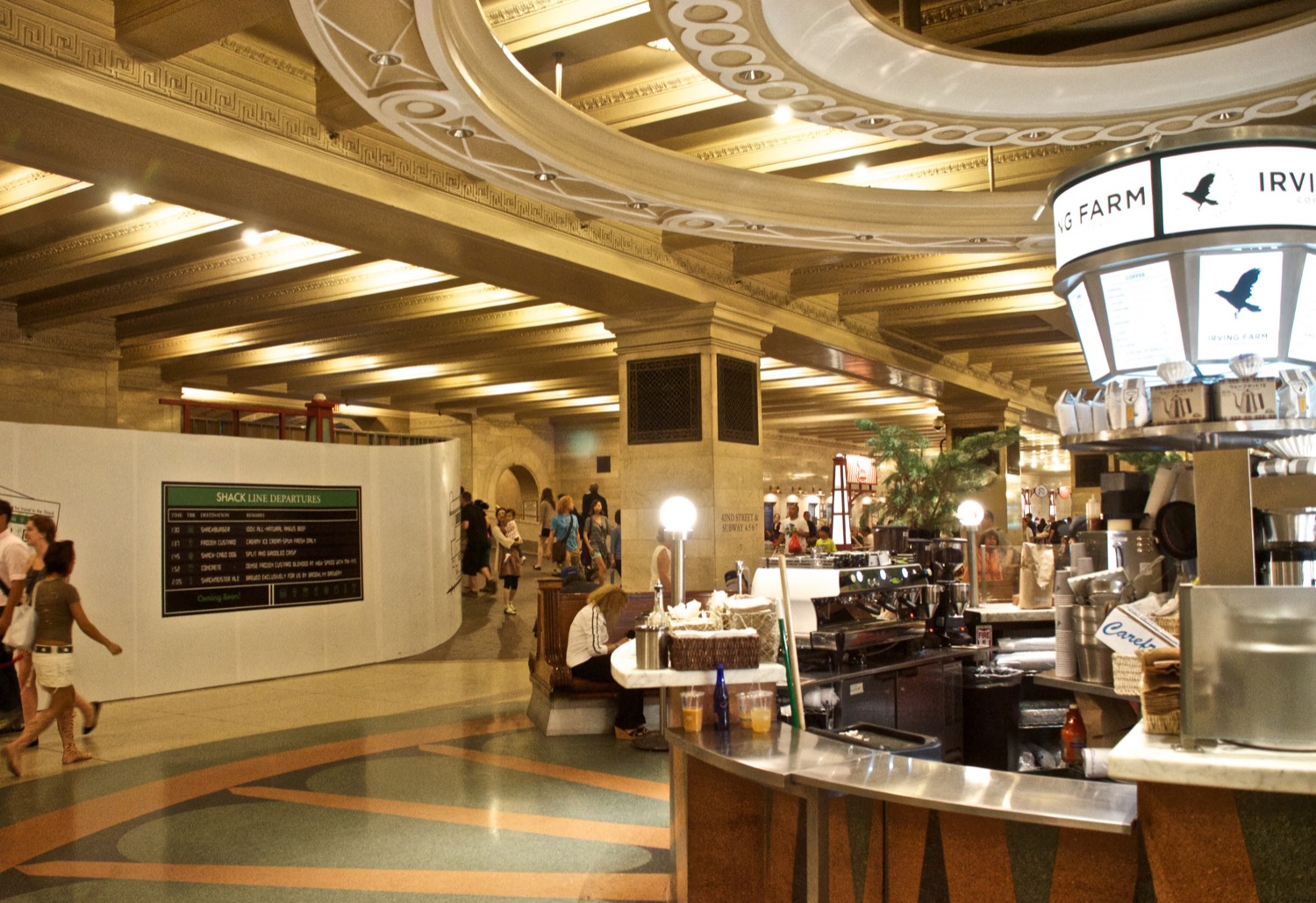
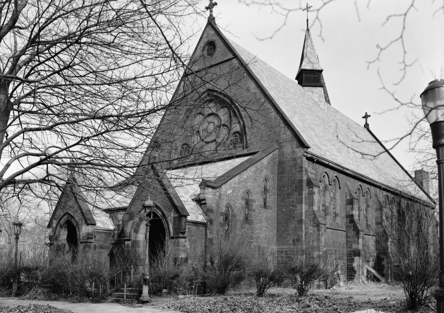
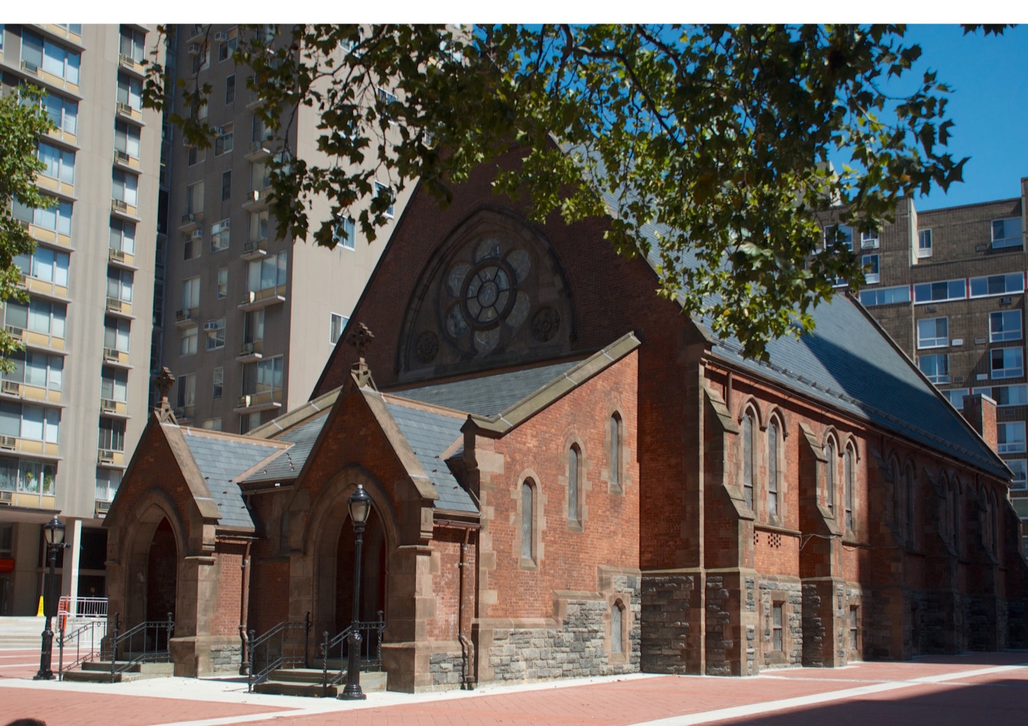
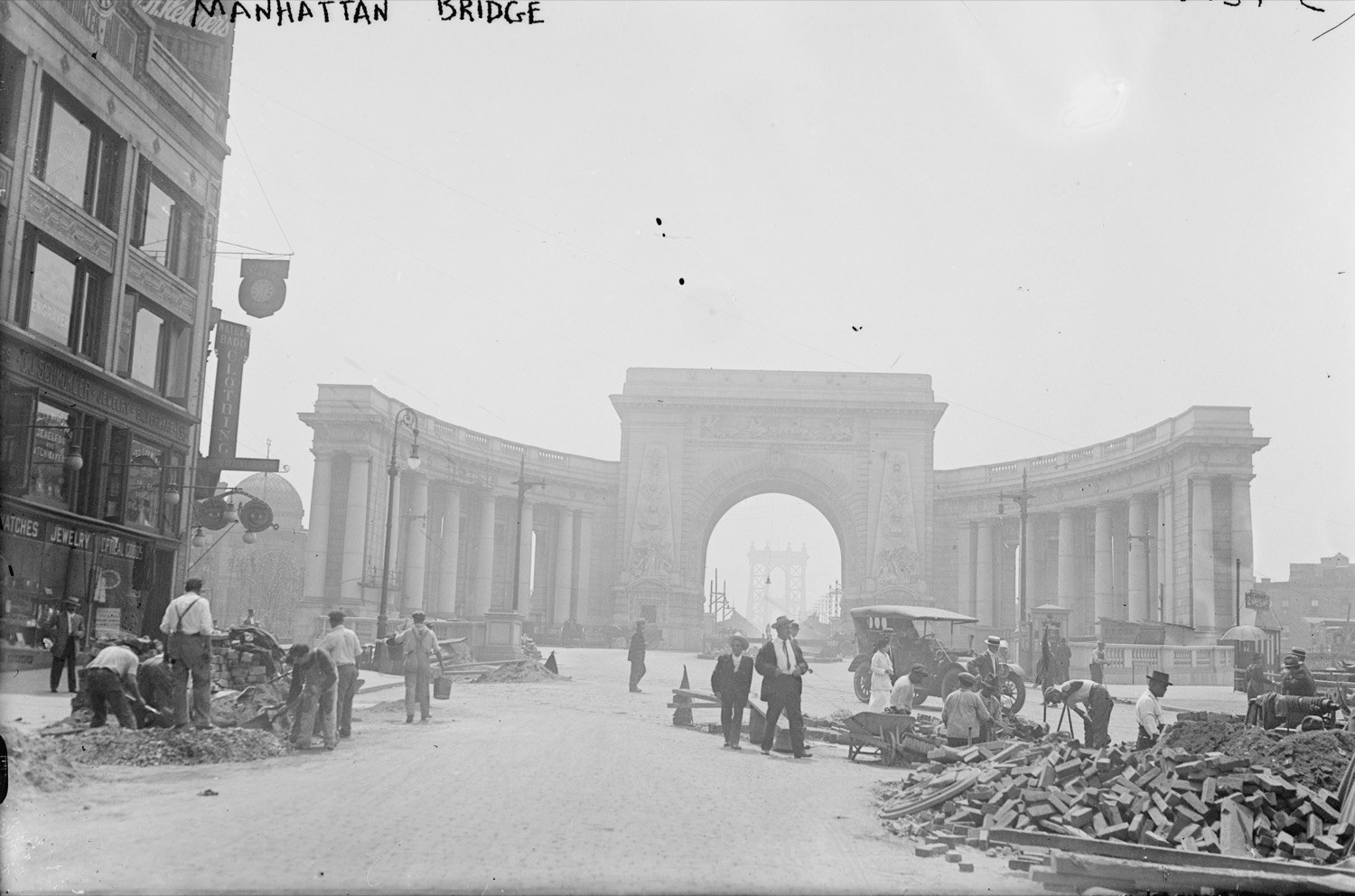
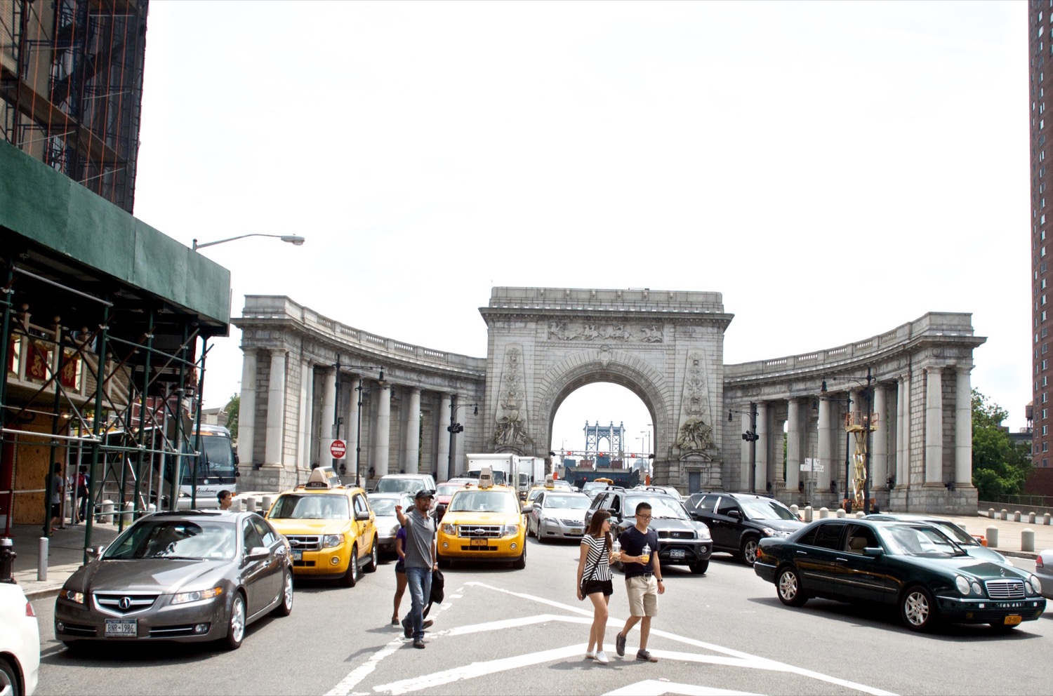
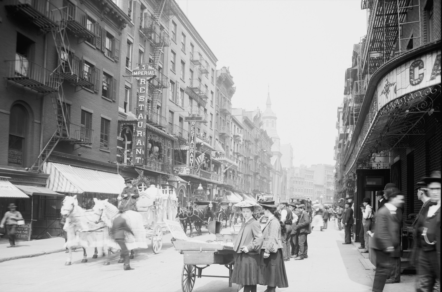
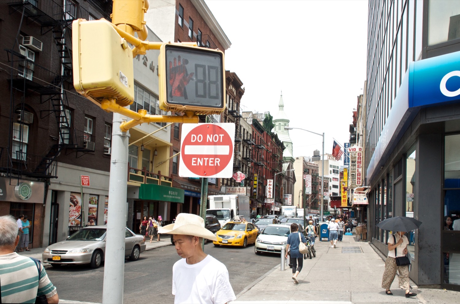
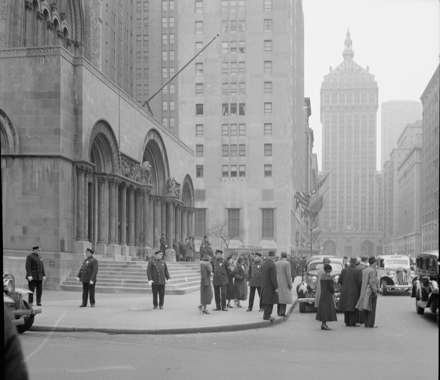
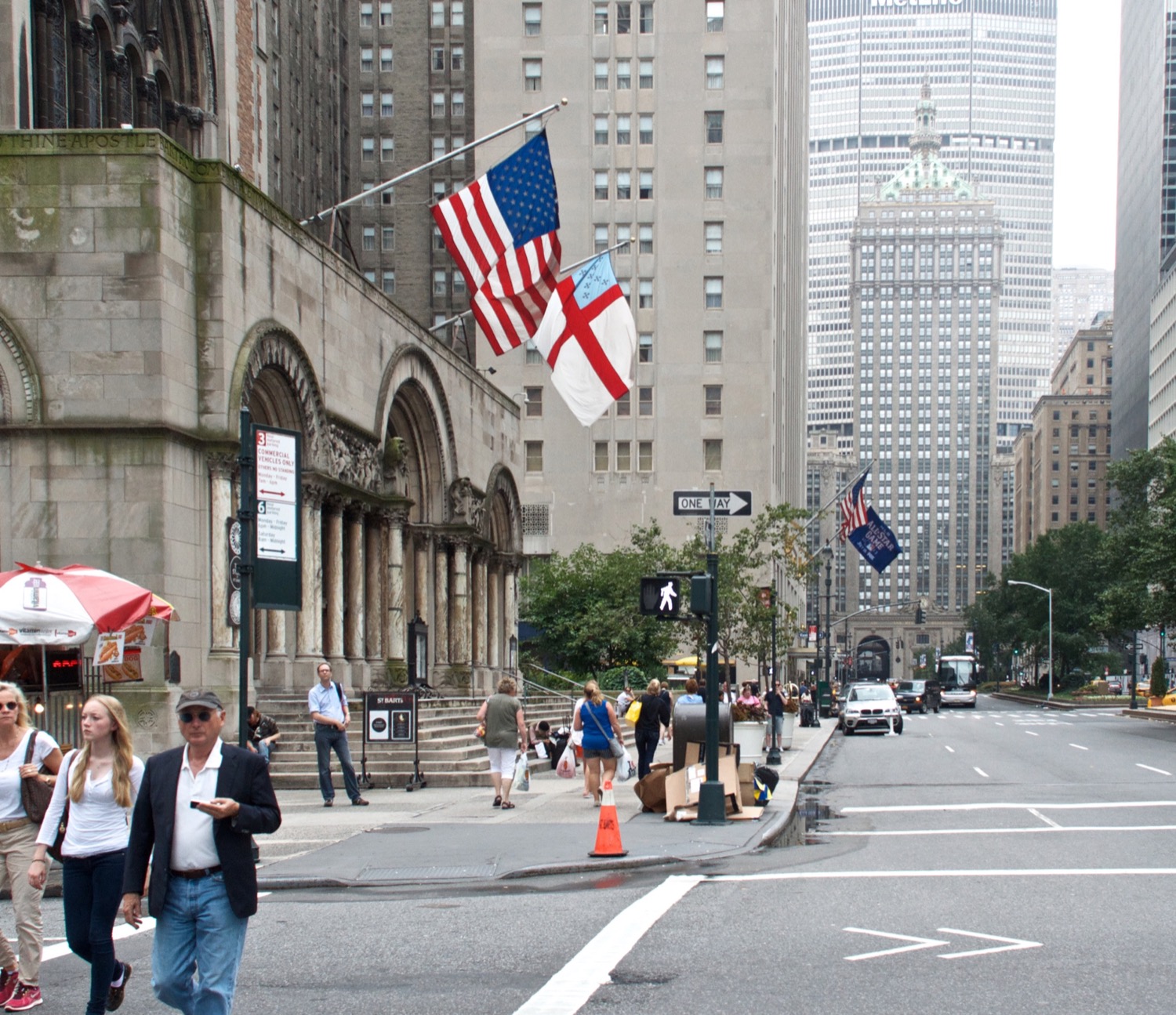
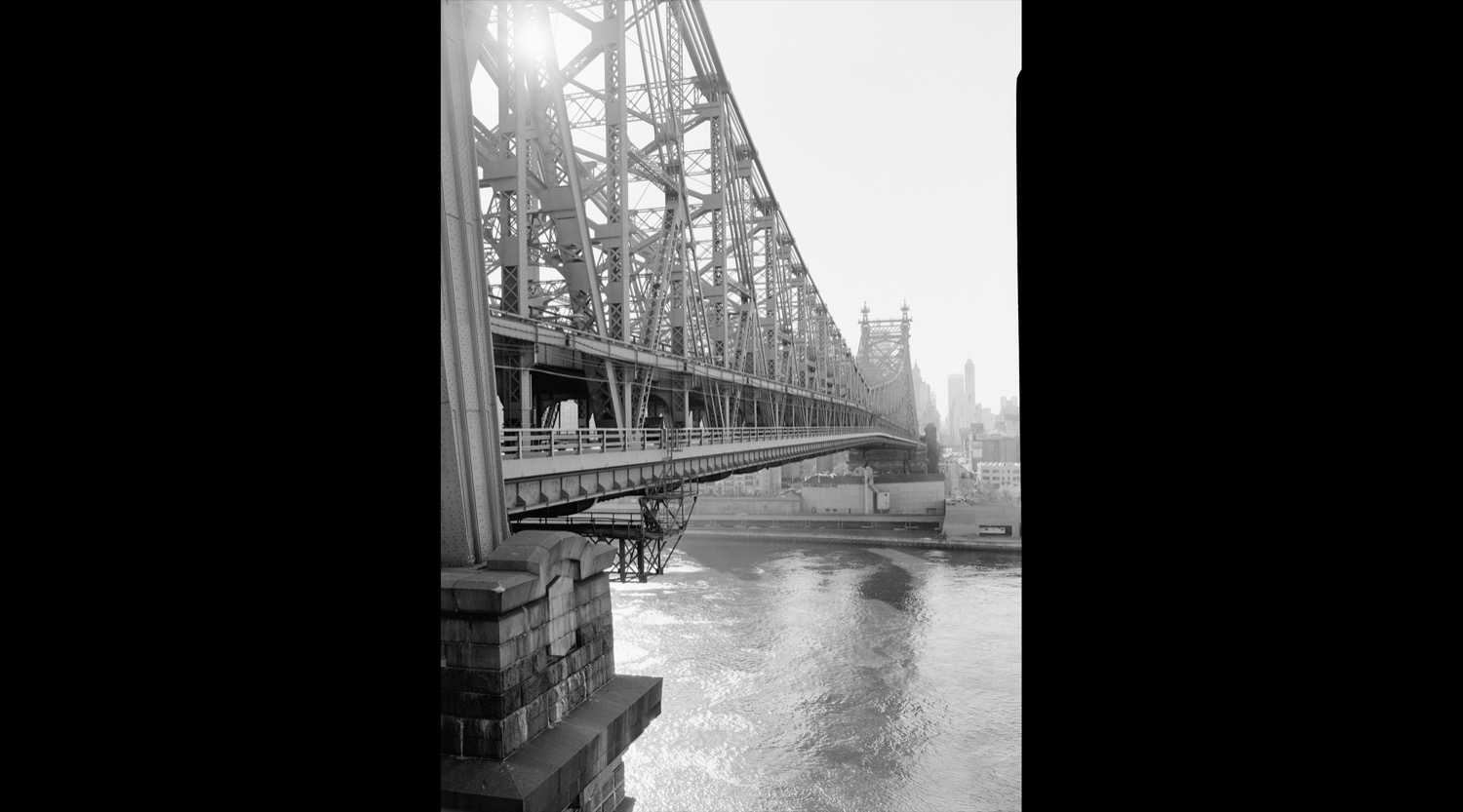
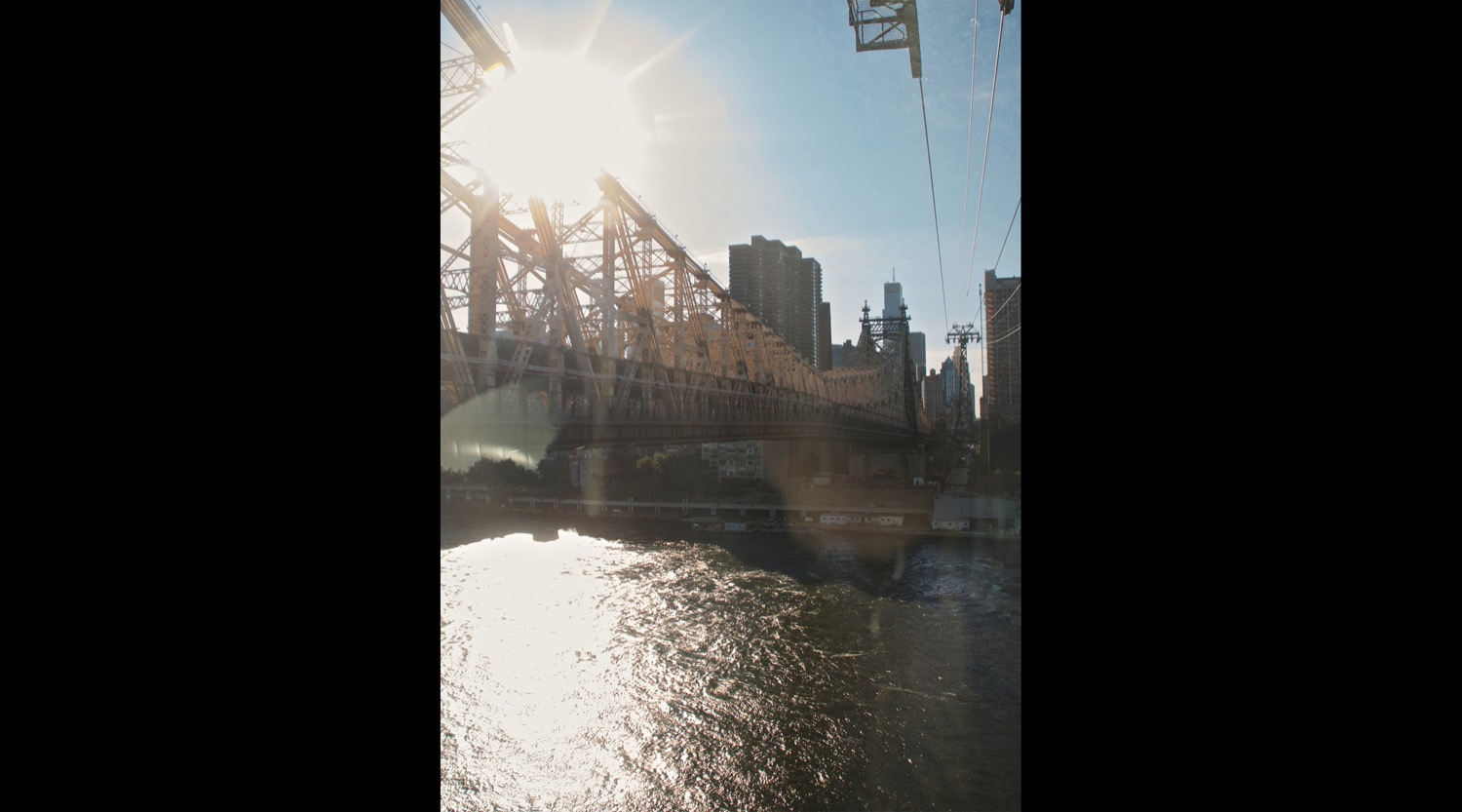
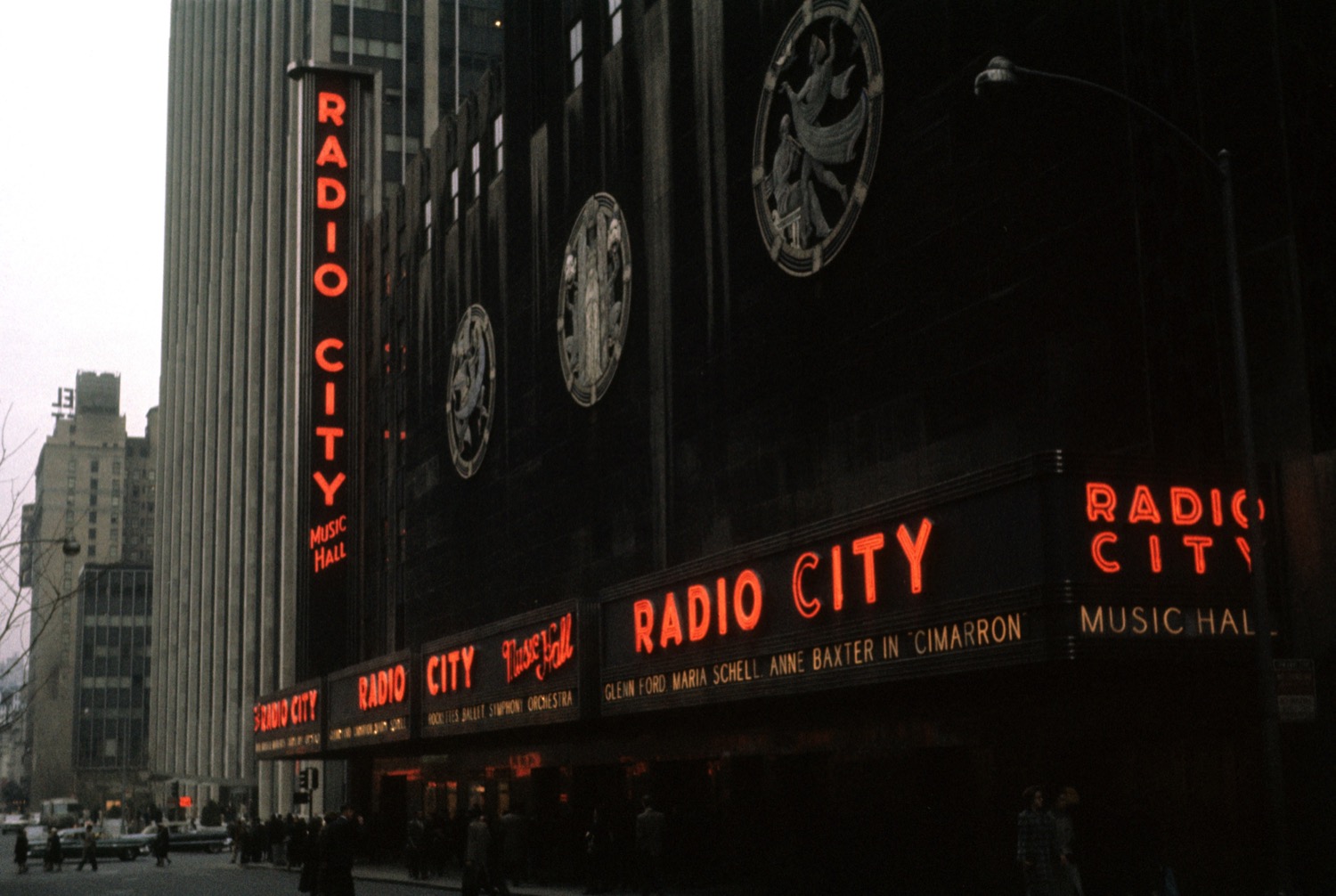
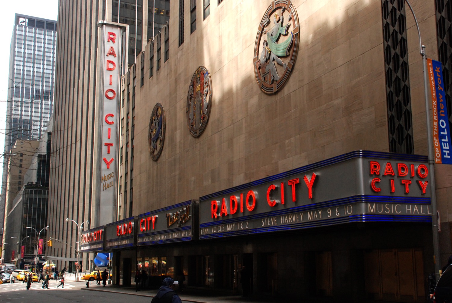
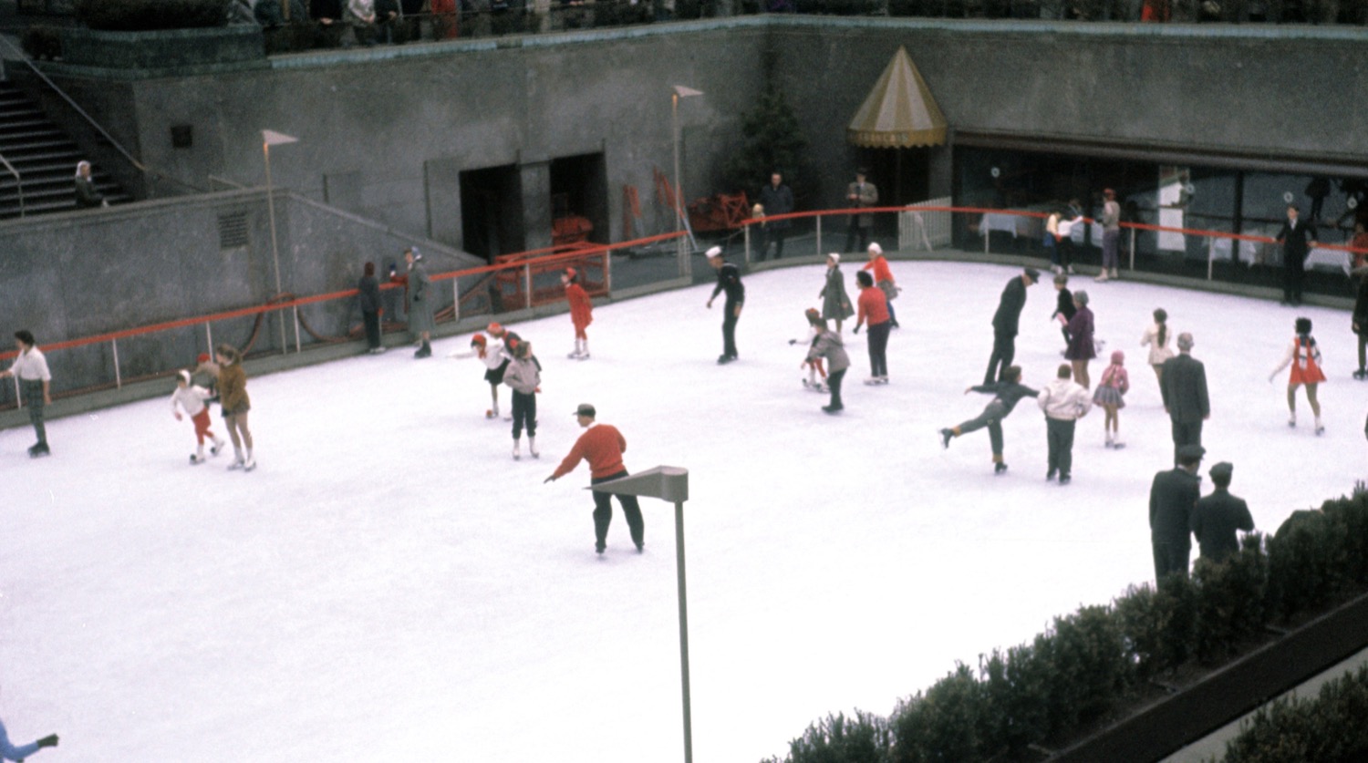
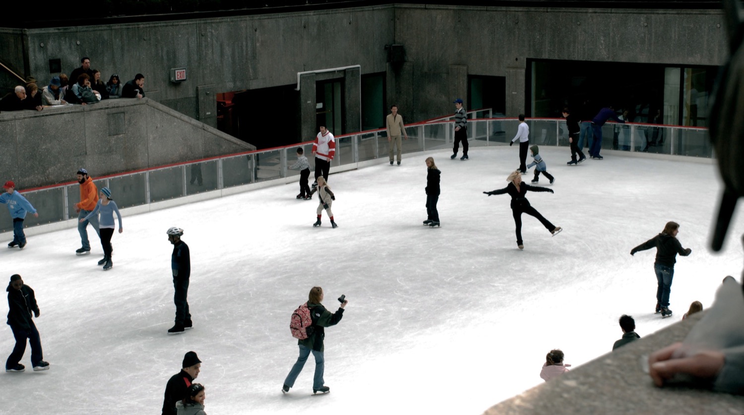
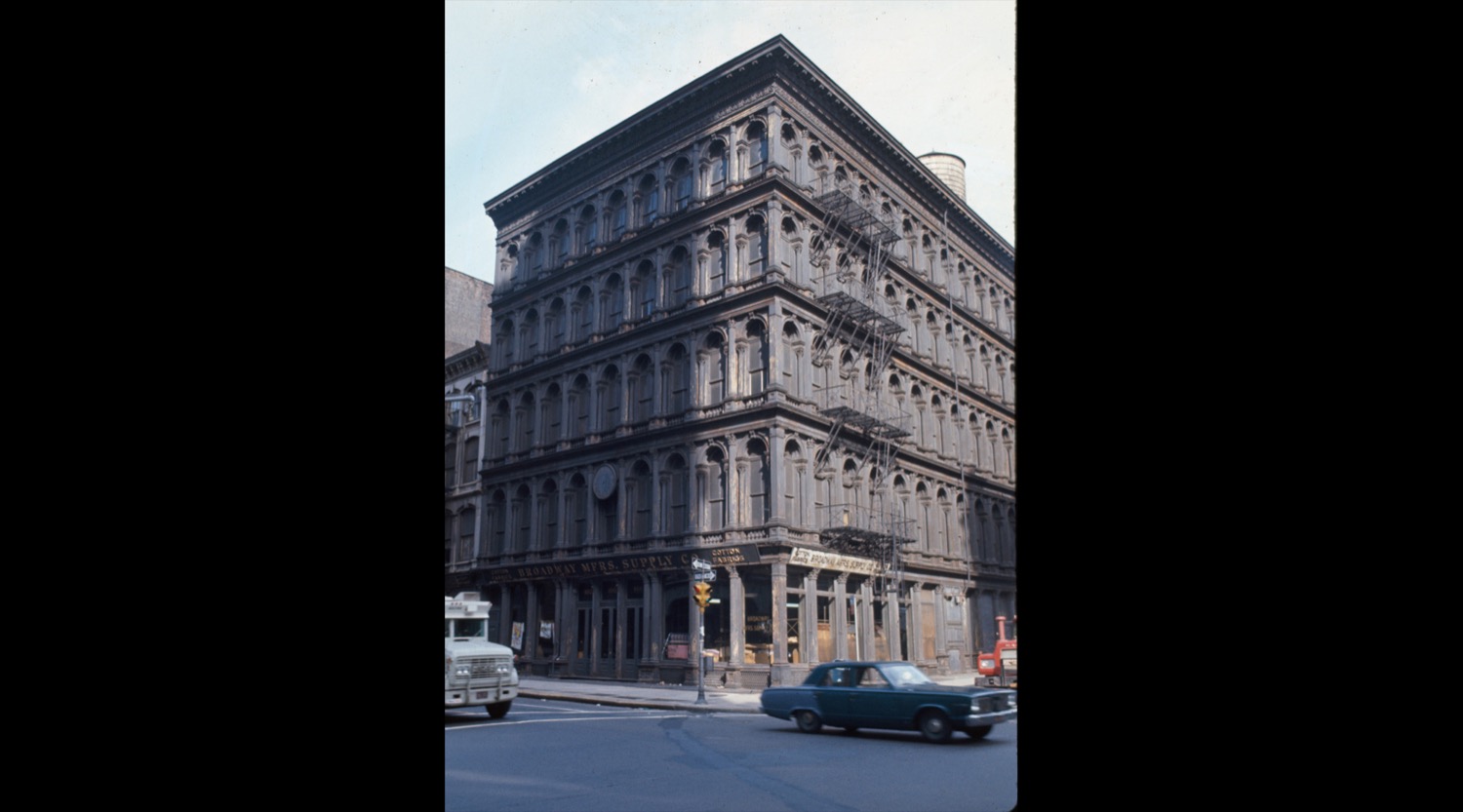
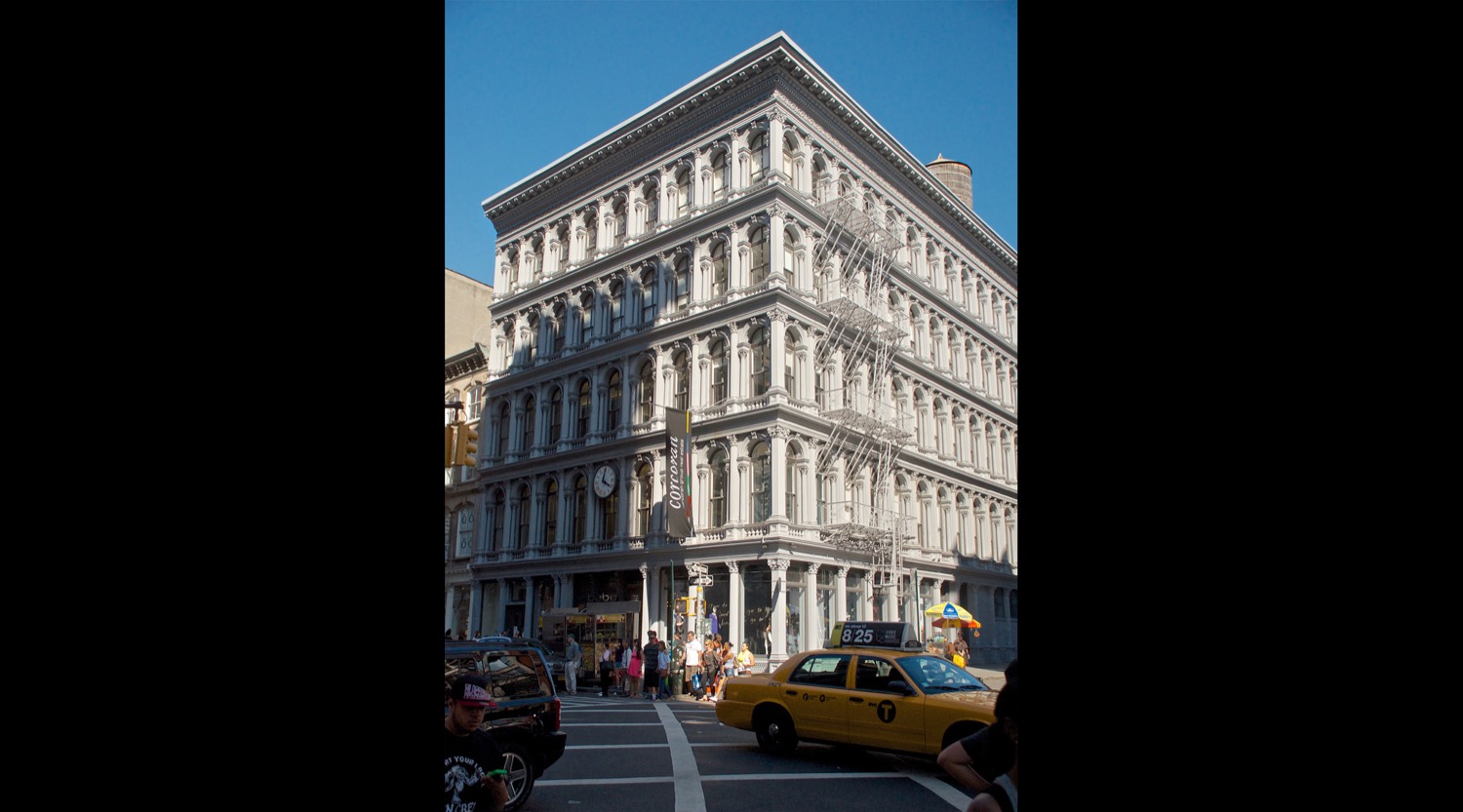
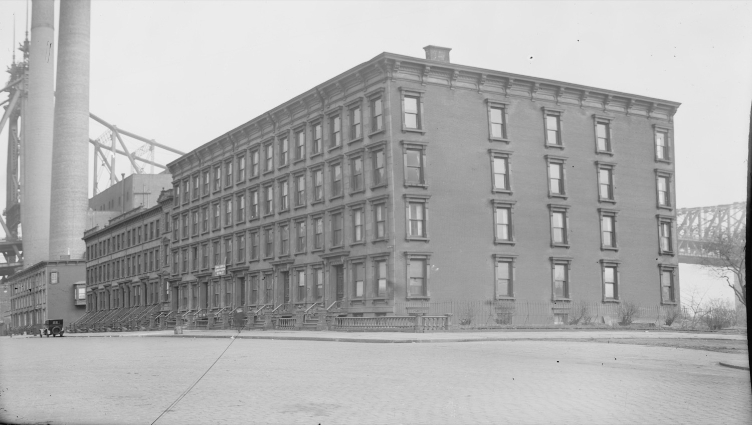
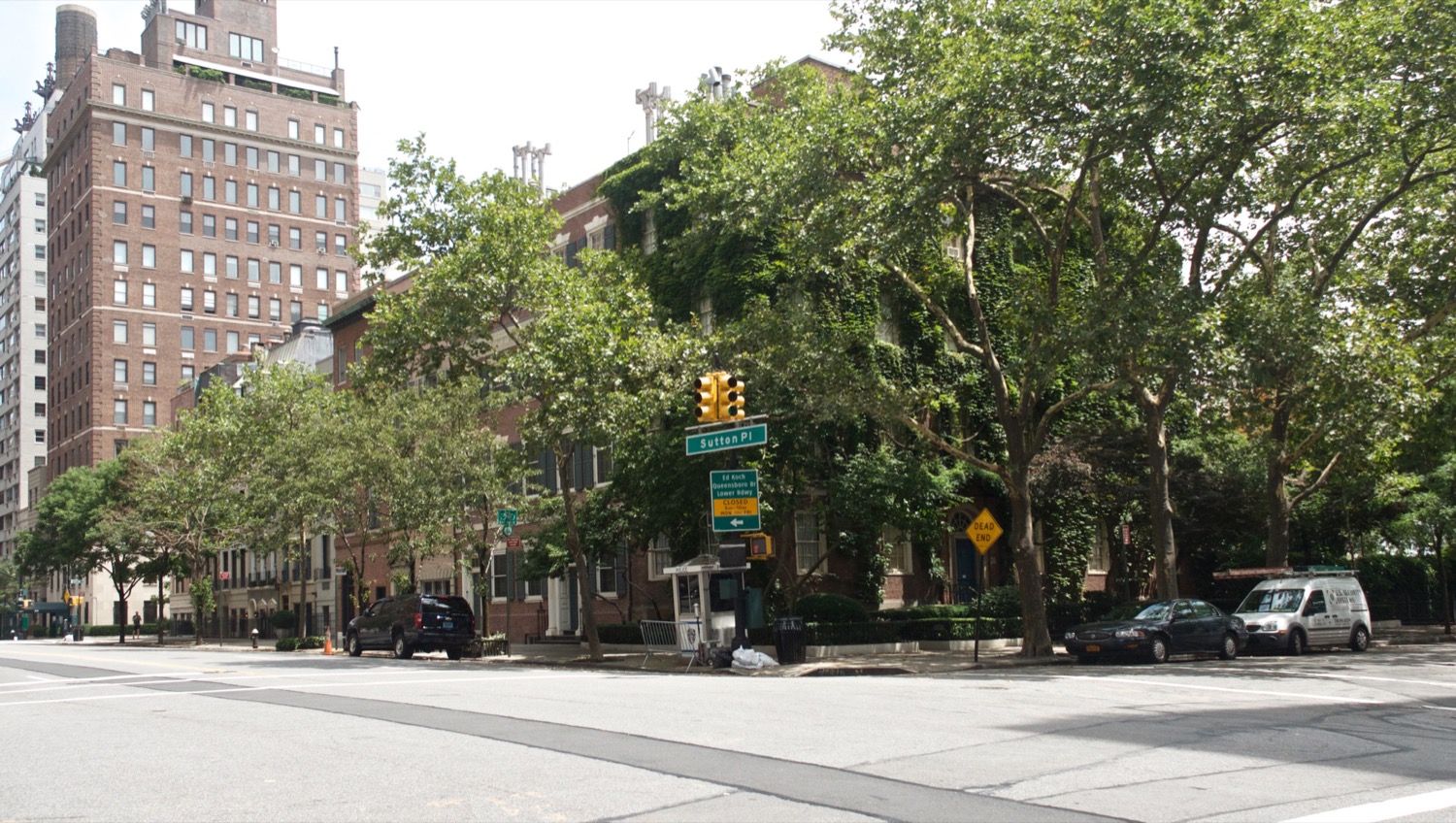
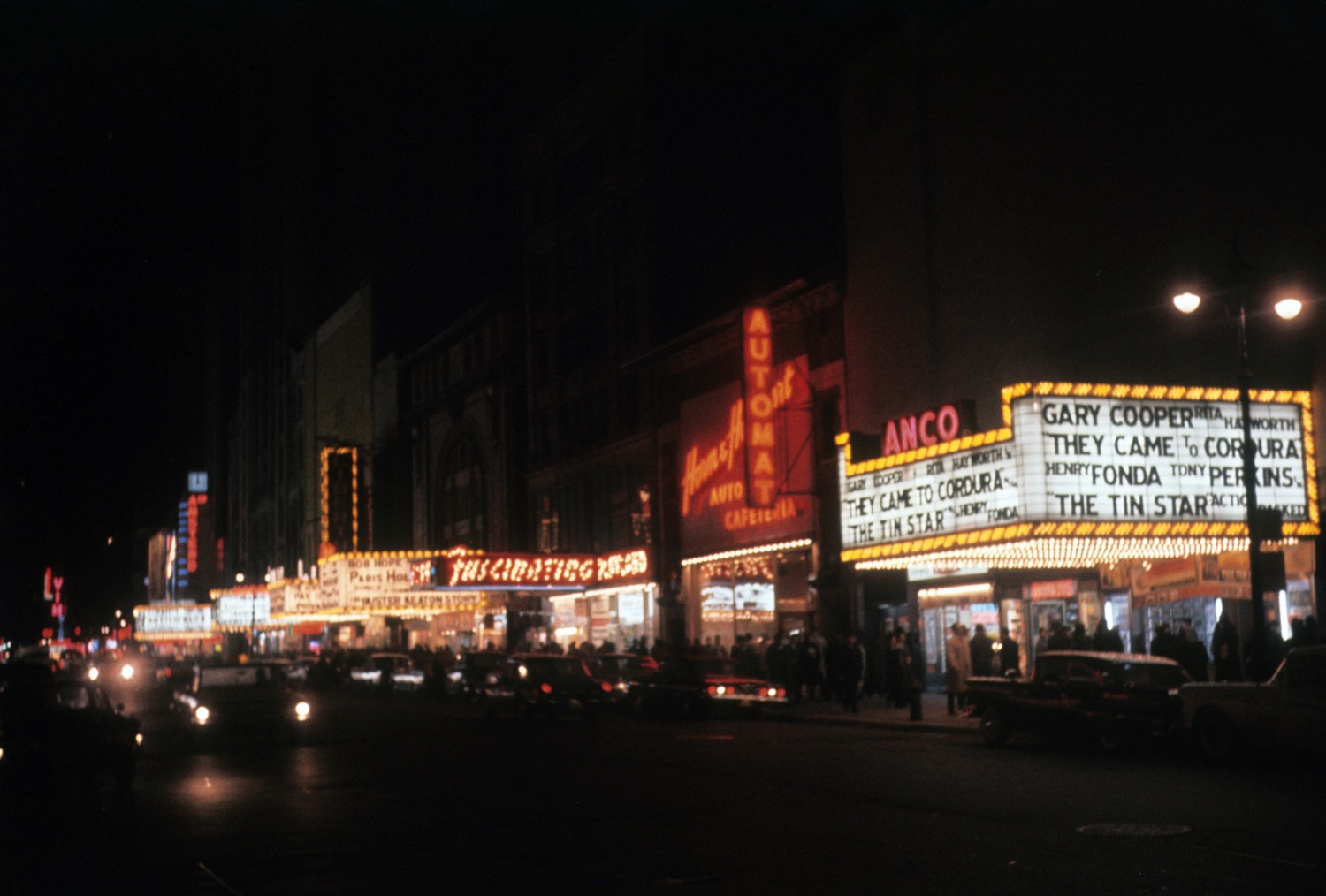
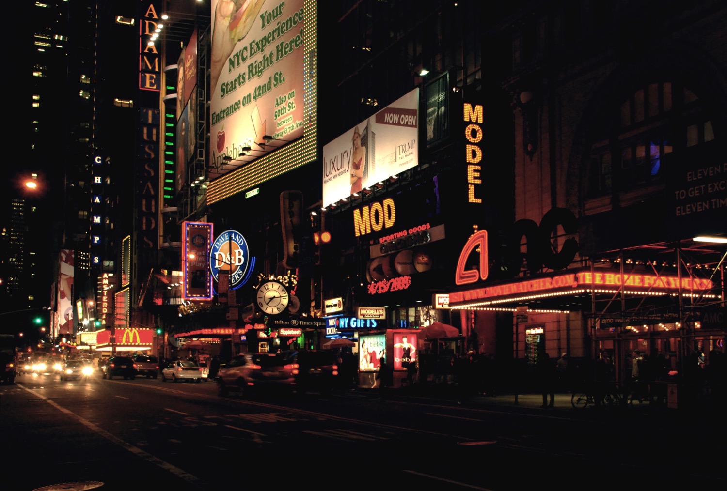
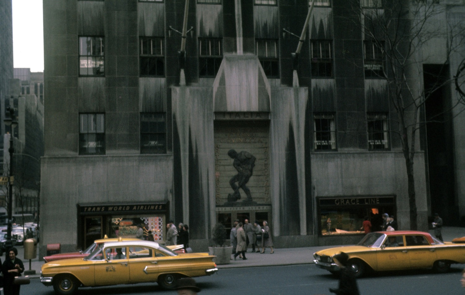
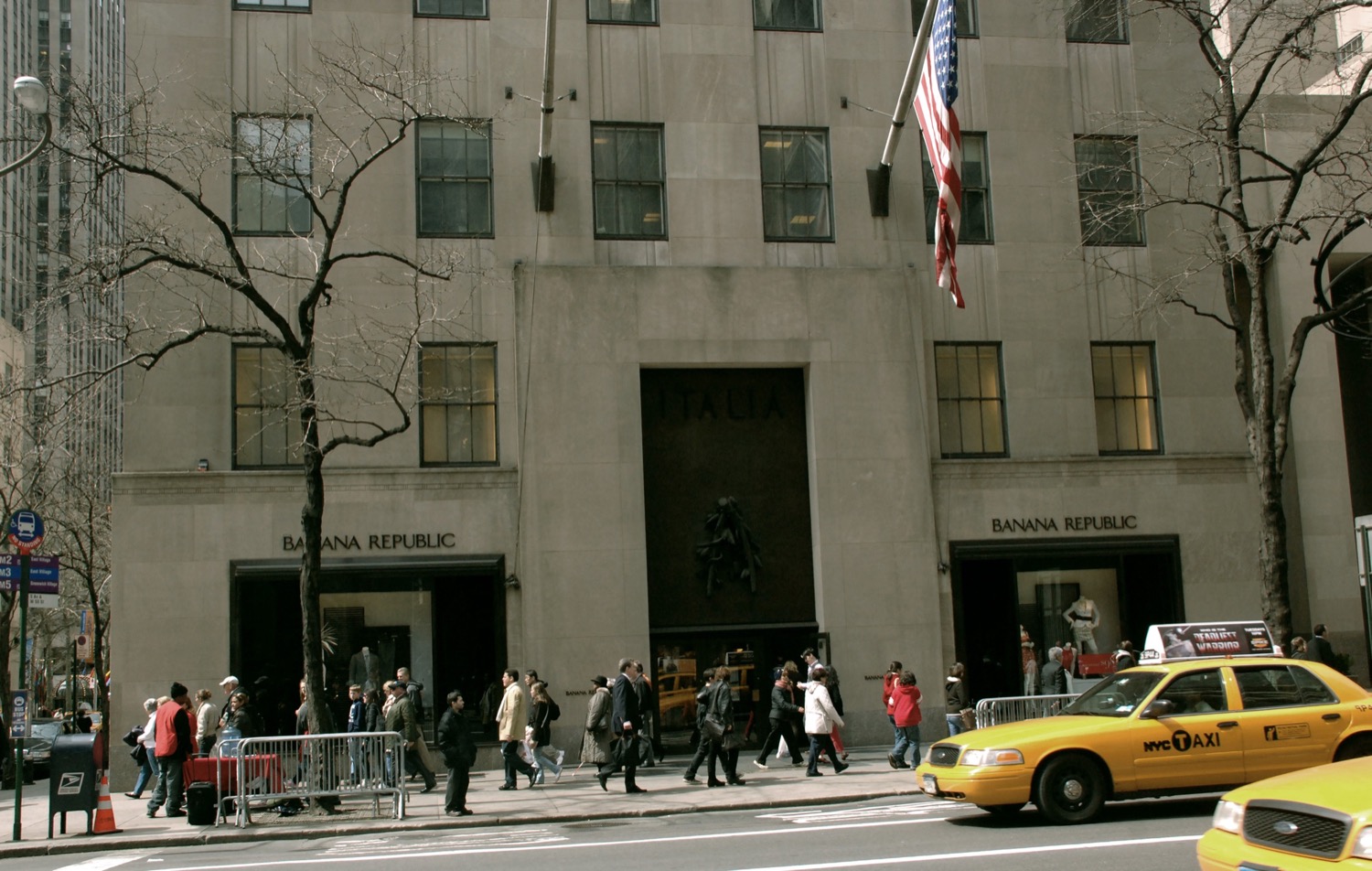
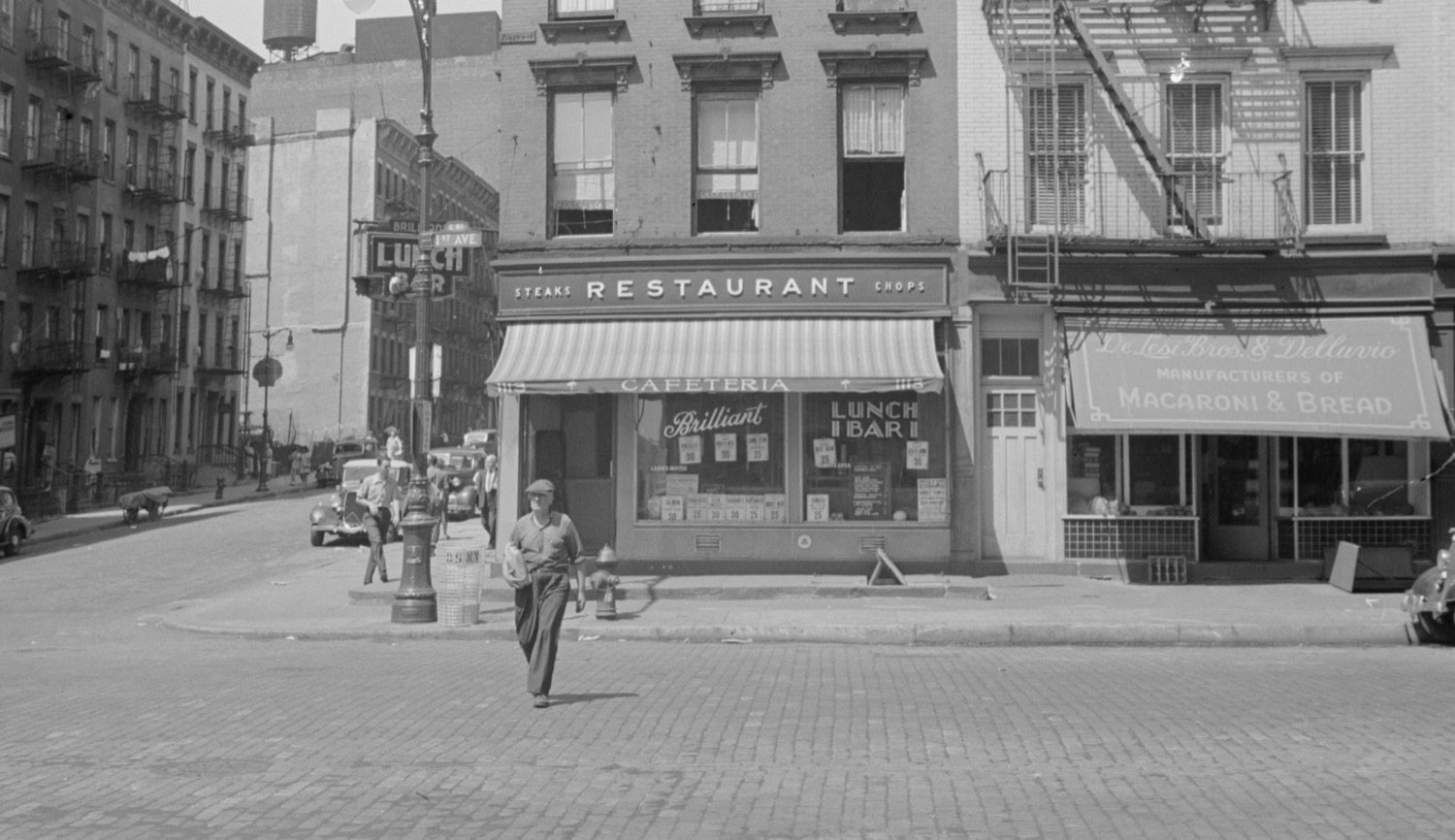
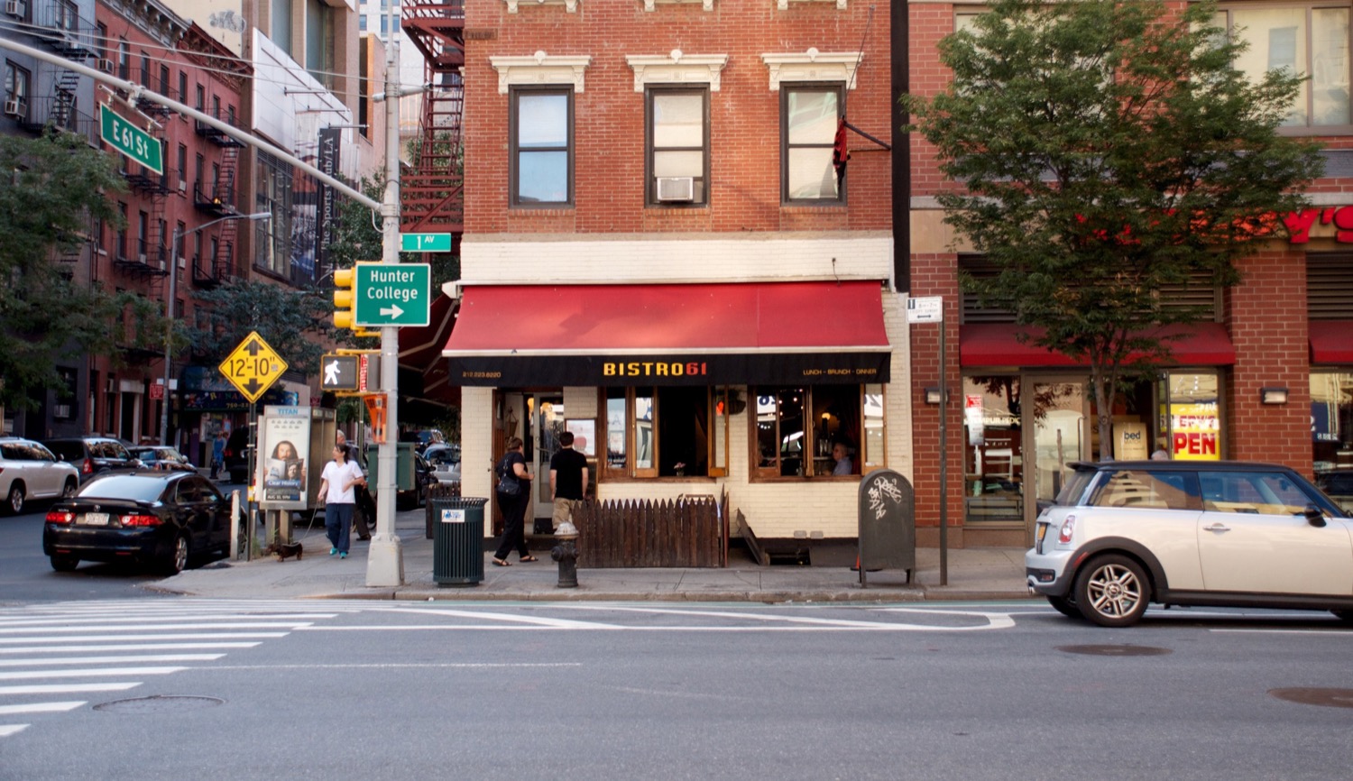
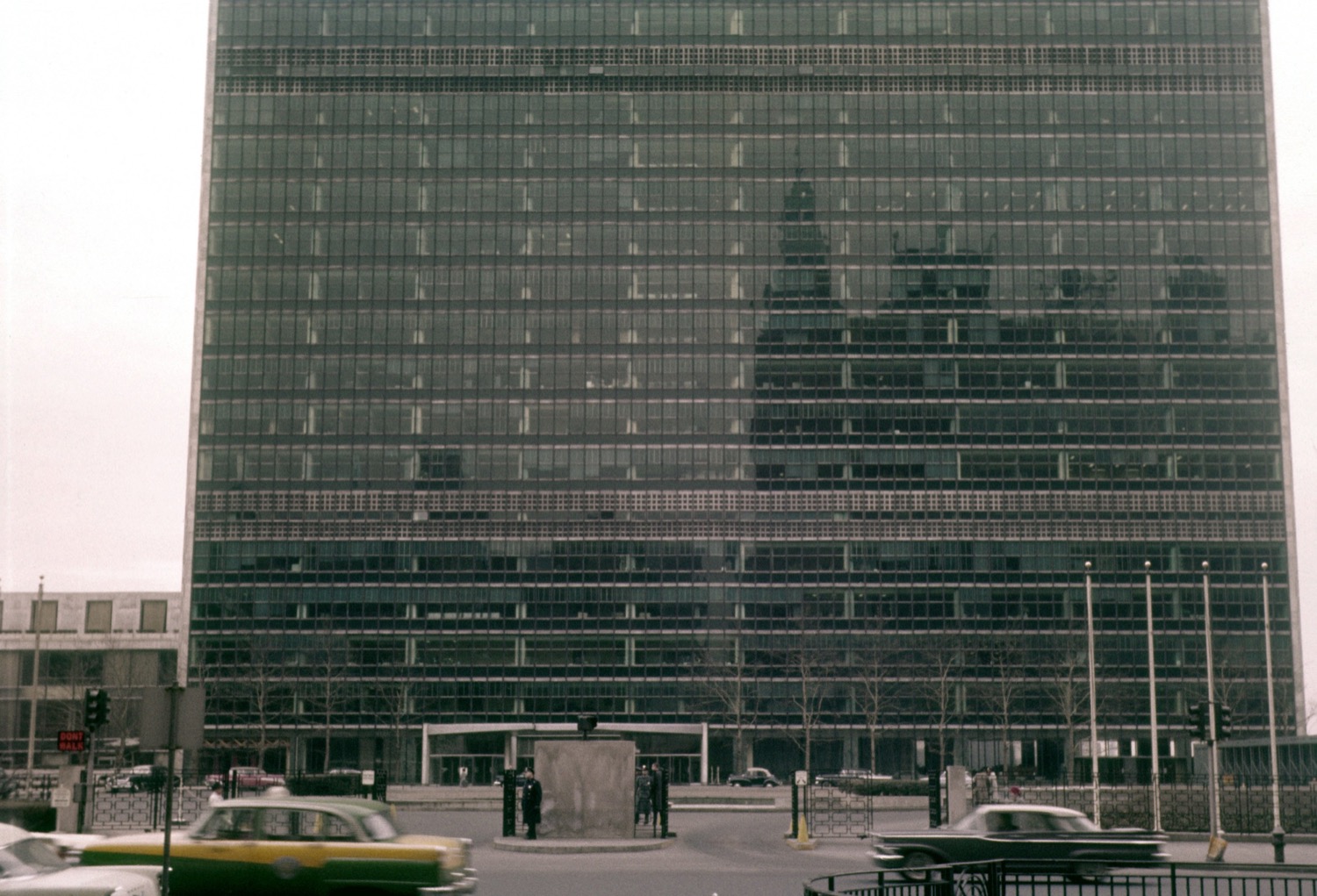
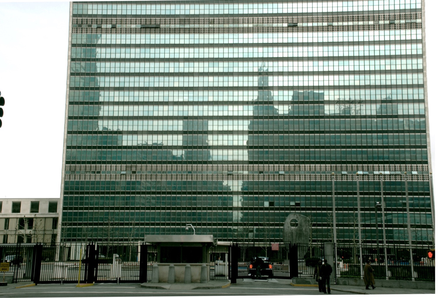
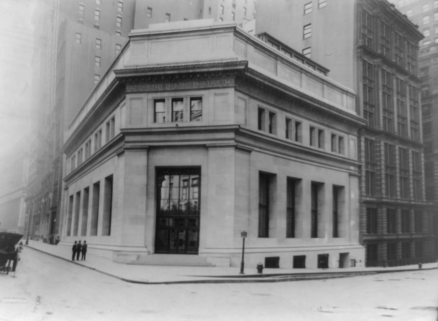
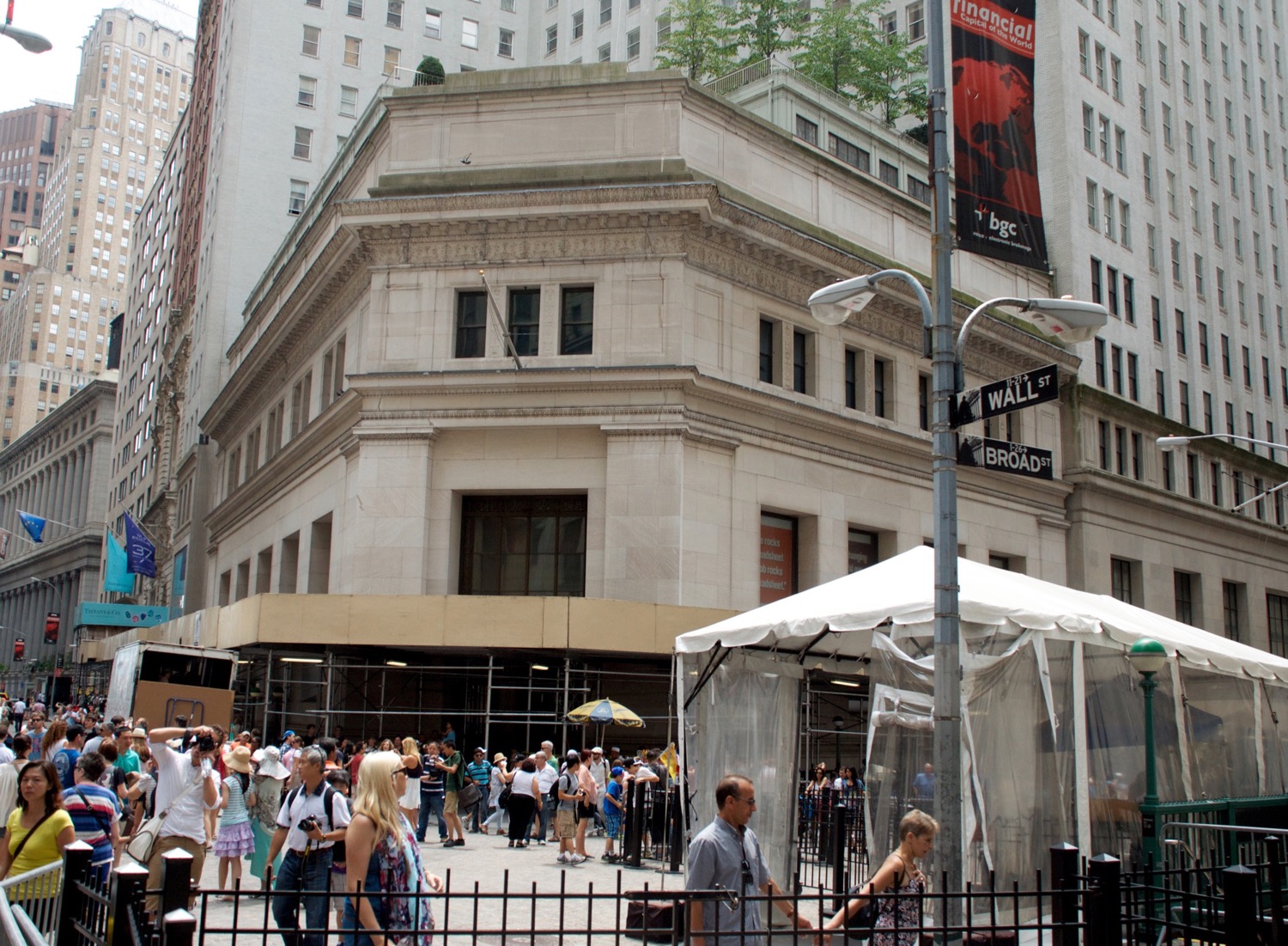
In 2008 I began a photo blog at nyc-grid.com. Billed as a street-by-street documentation of the 5 boroughs, each weekday I would post a photo essay of a different block. Though the blog was modestly popular after only a few months, it really took off after I began featuring a series called Before & After.
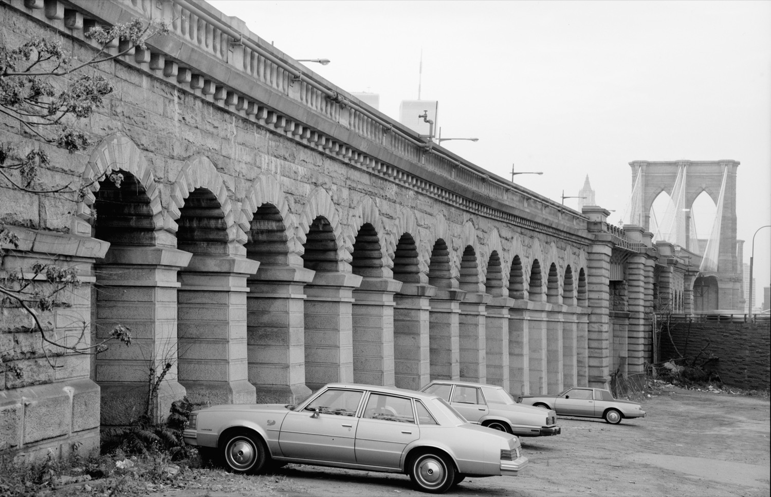
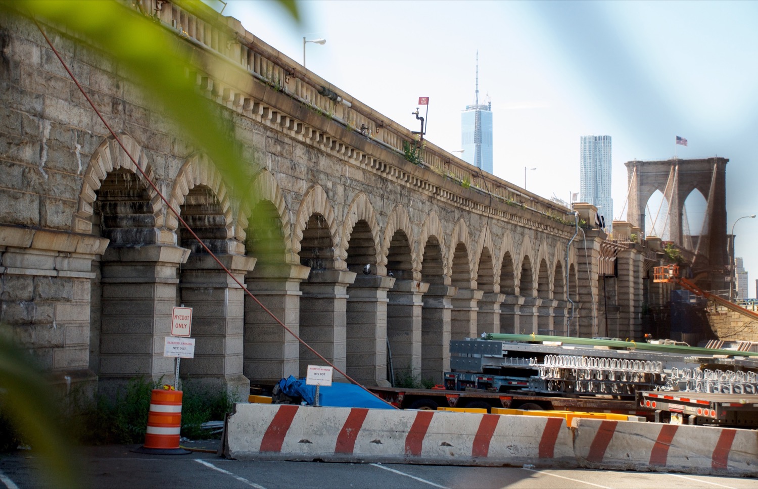
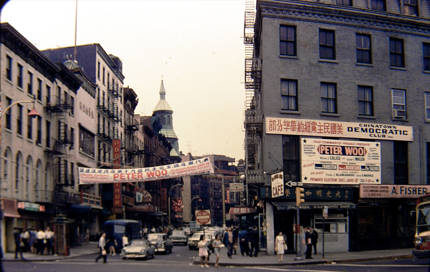
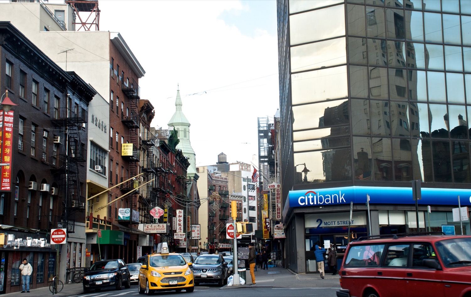
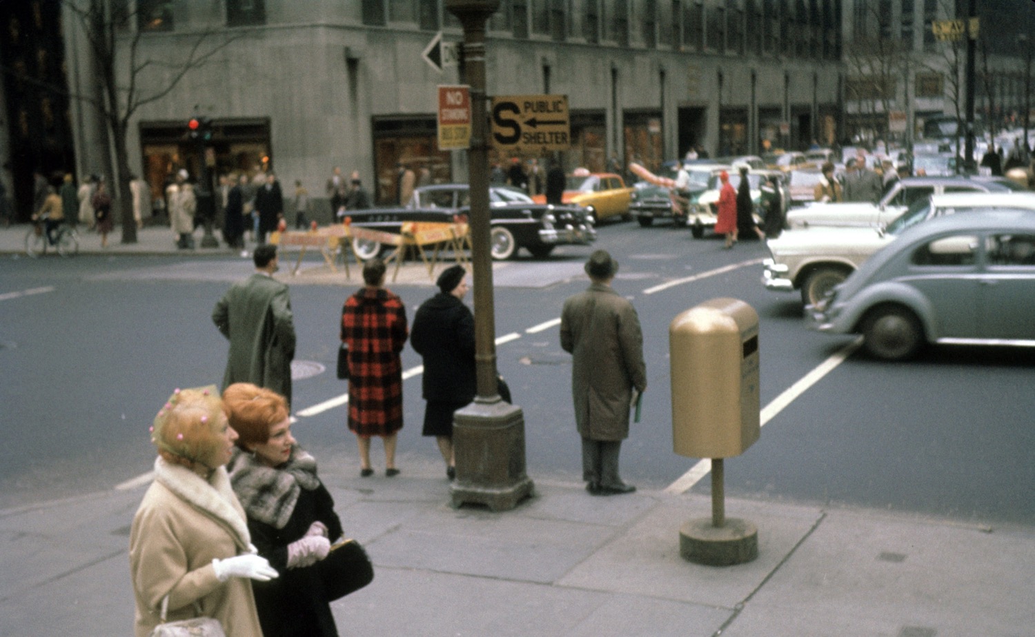
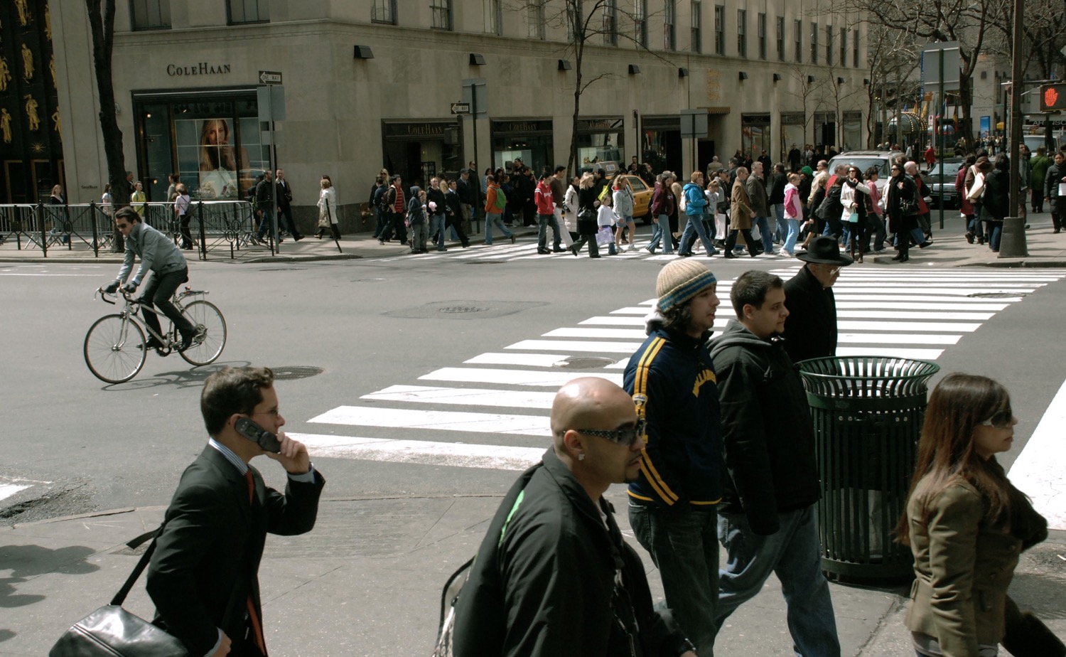
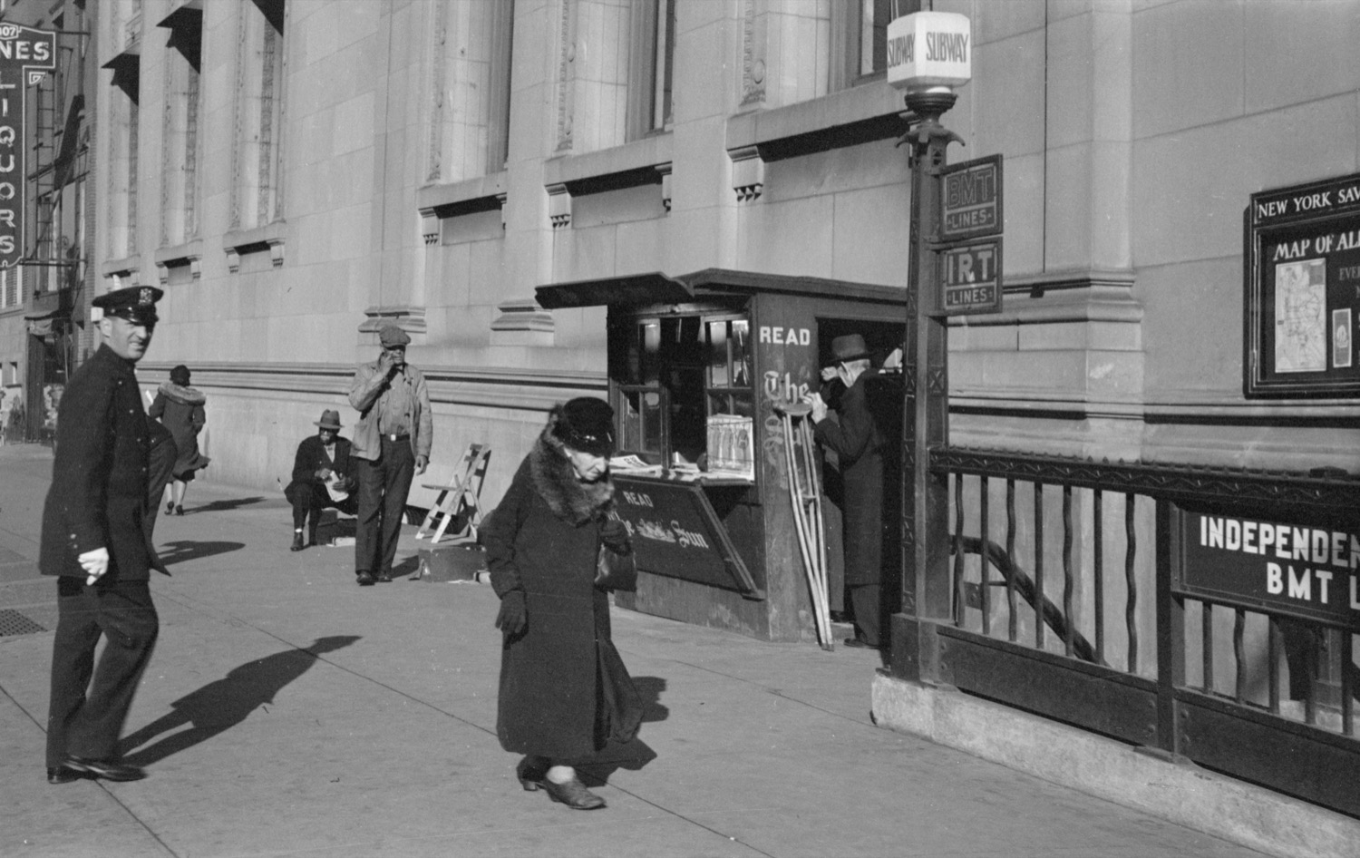
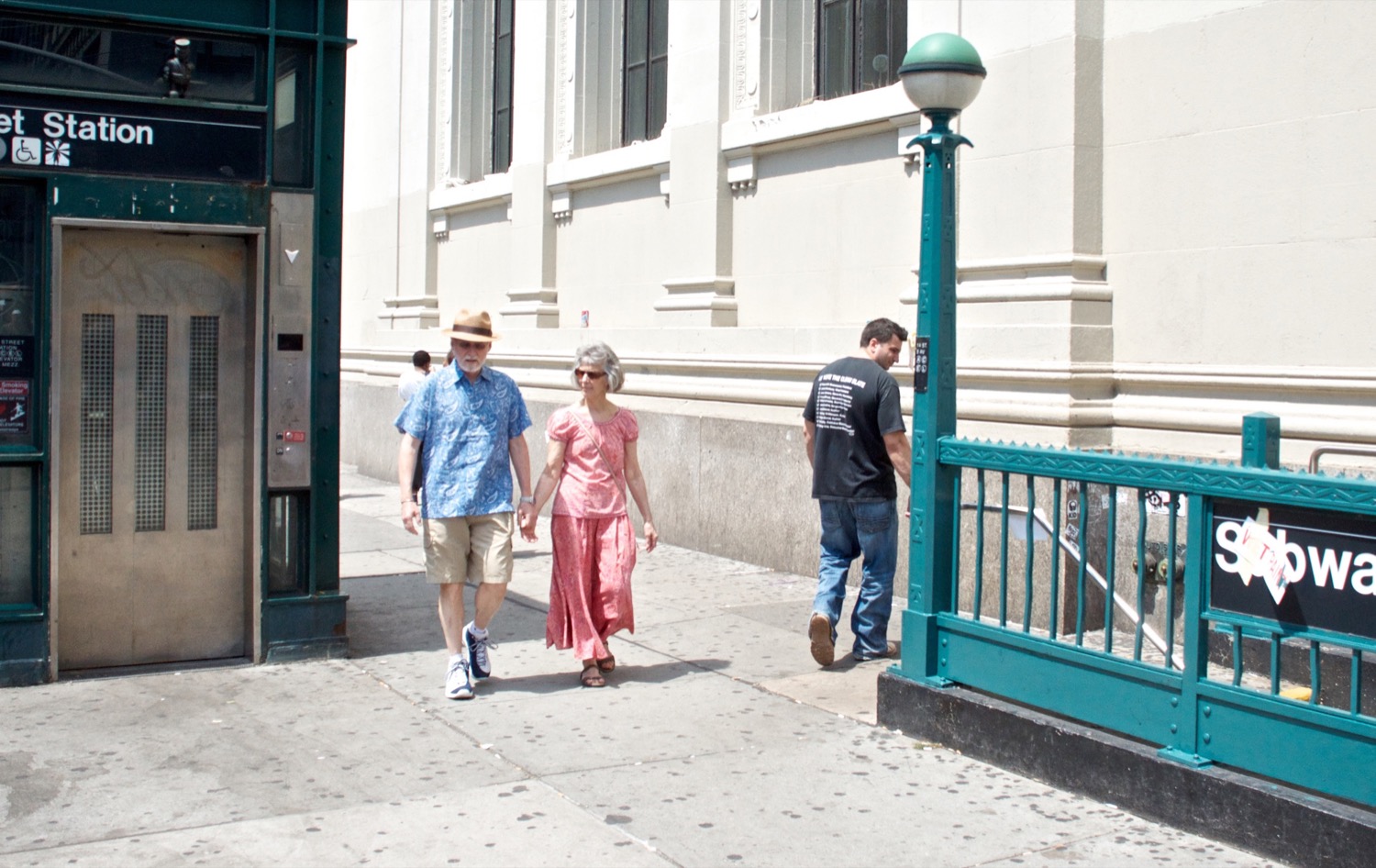
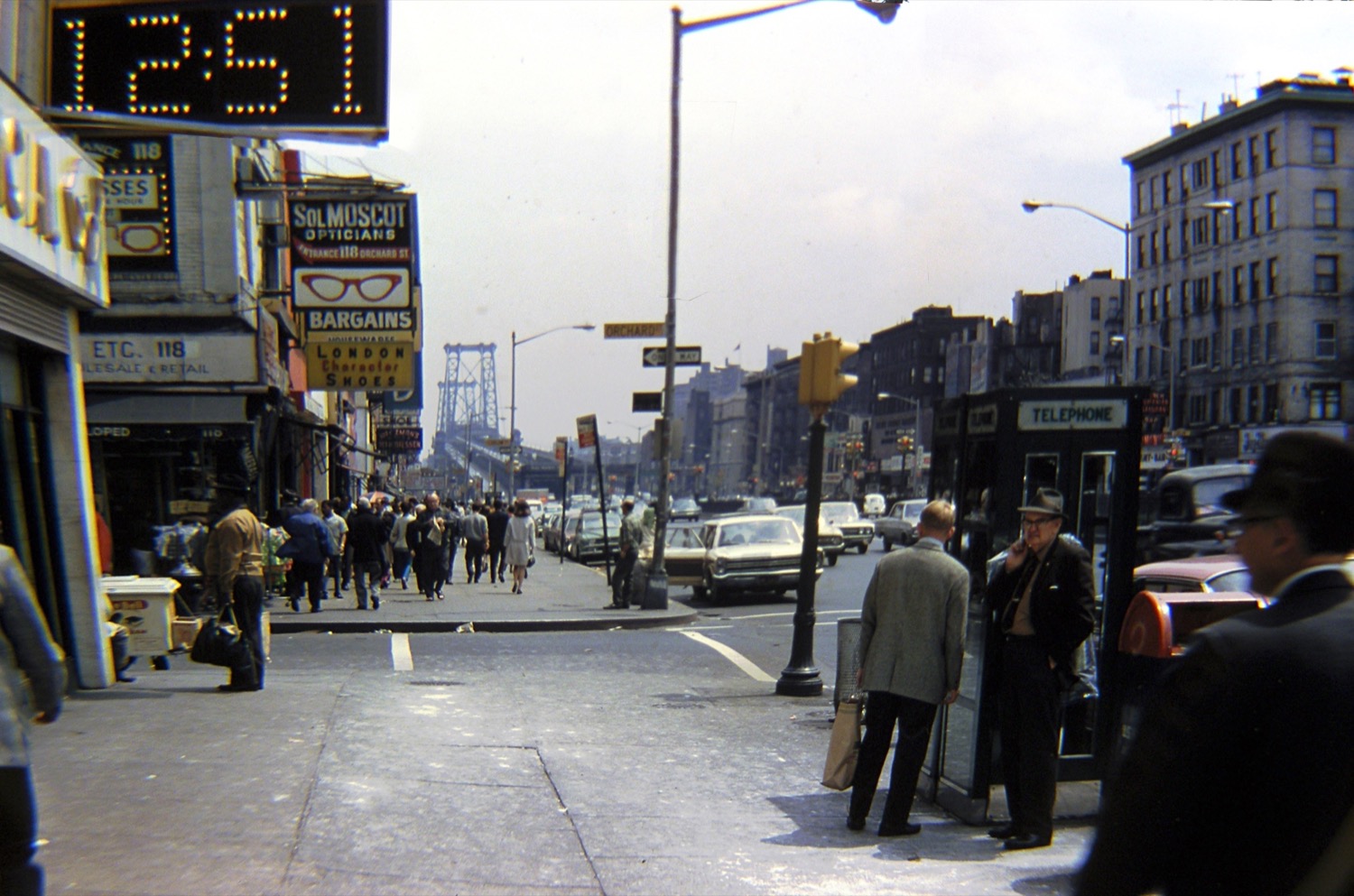
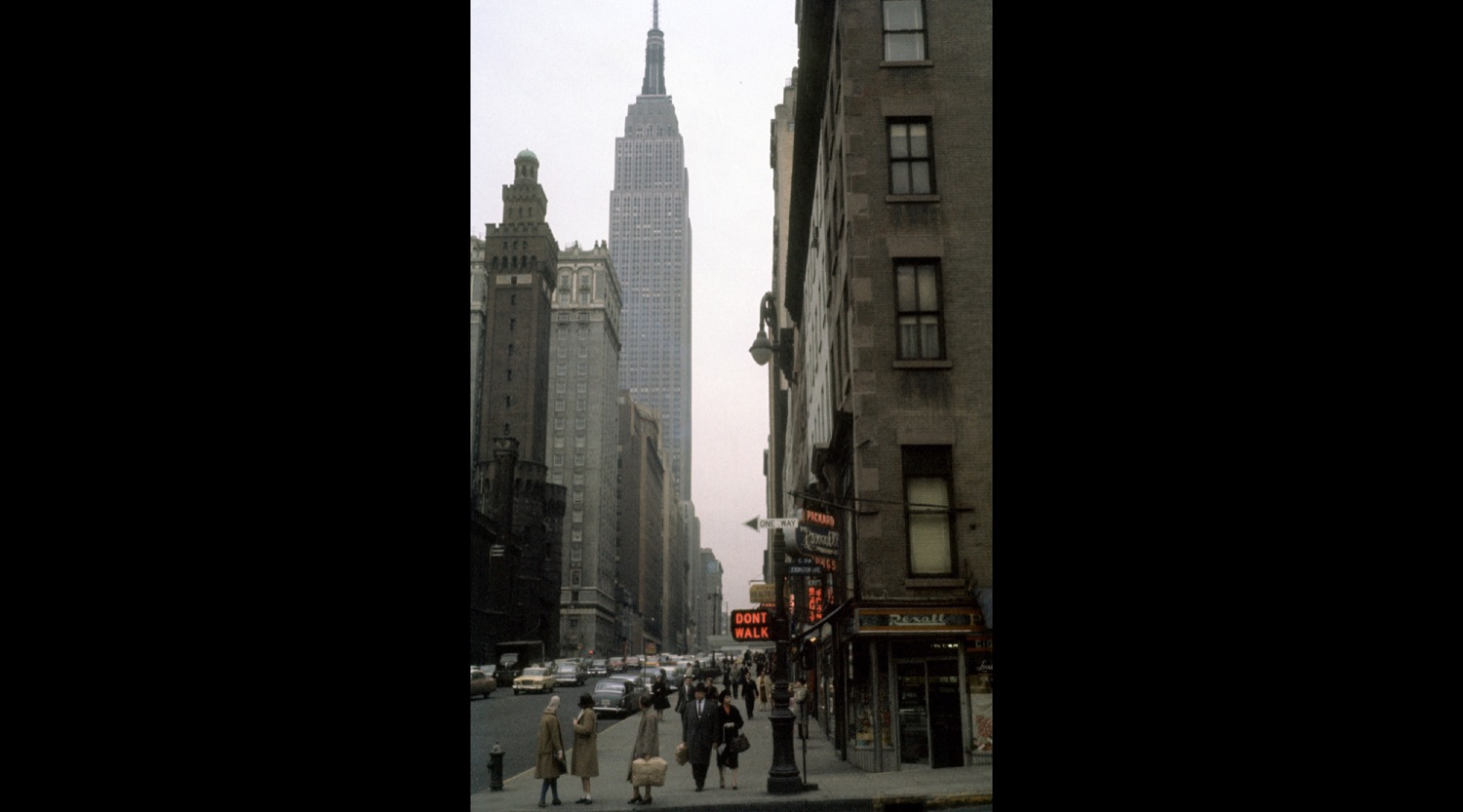
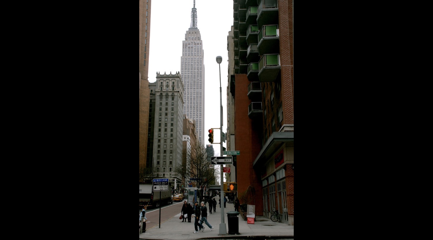
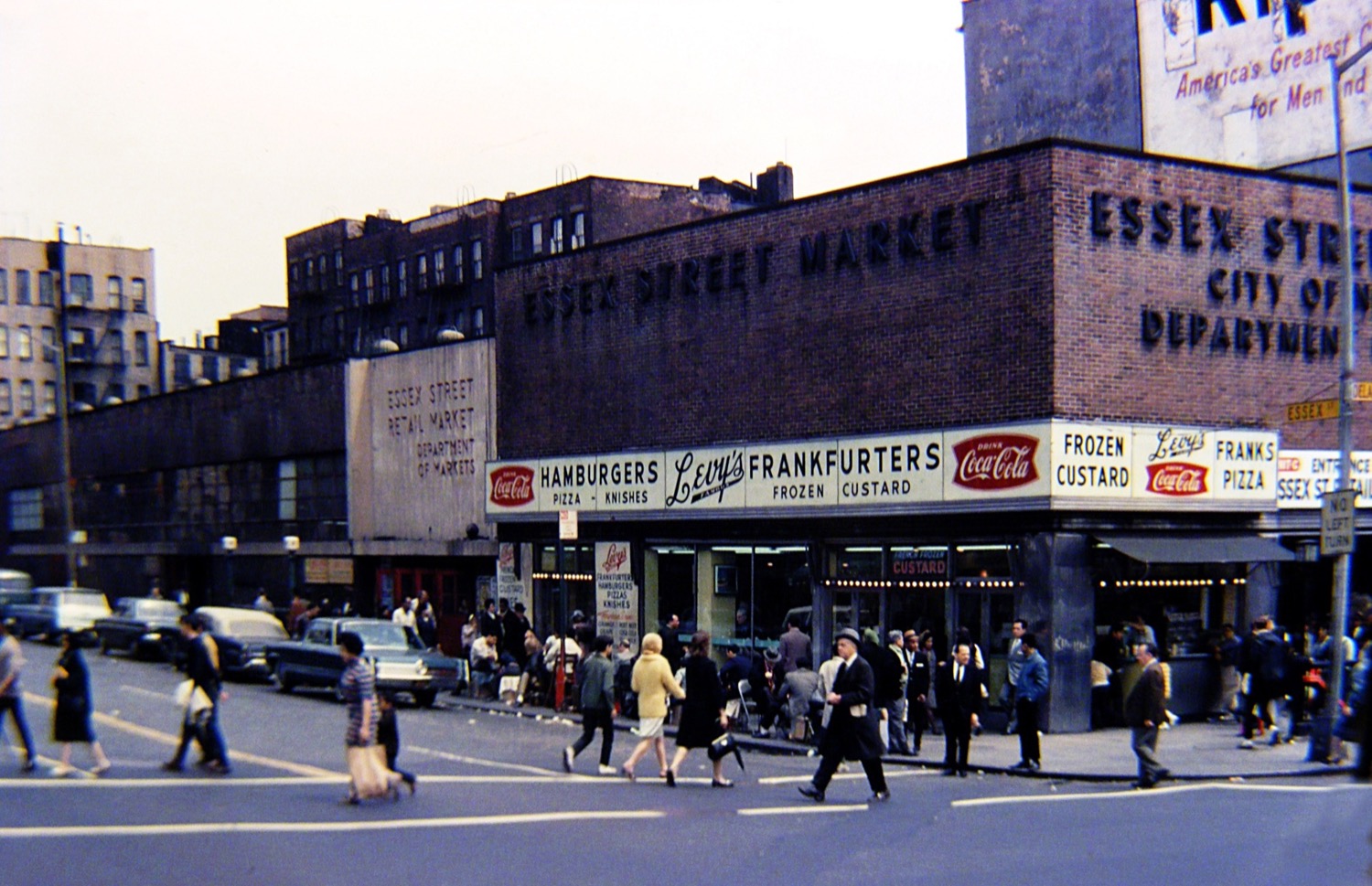
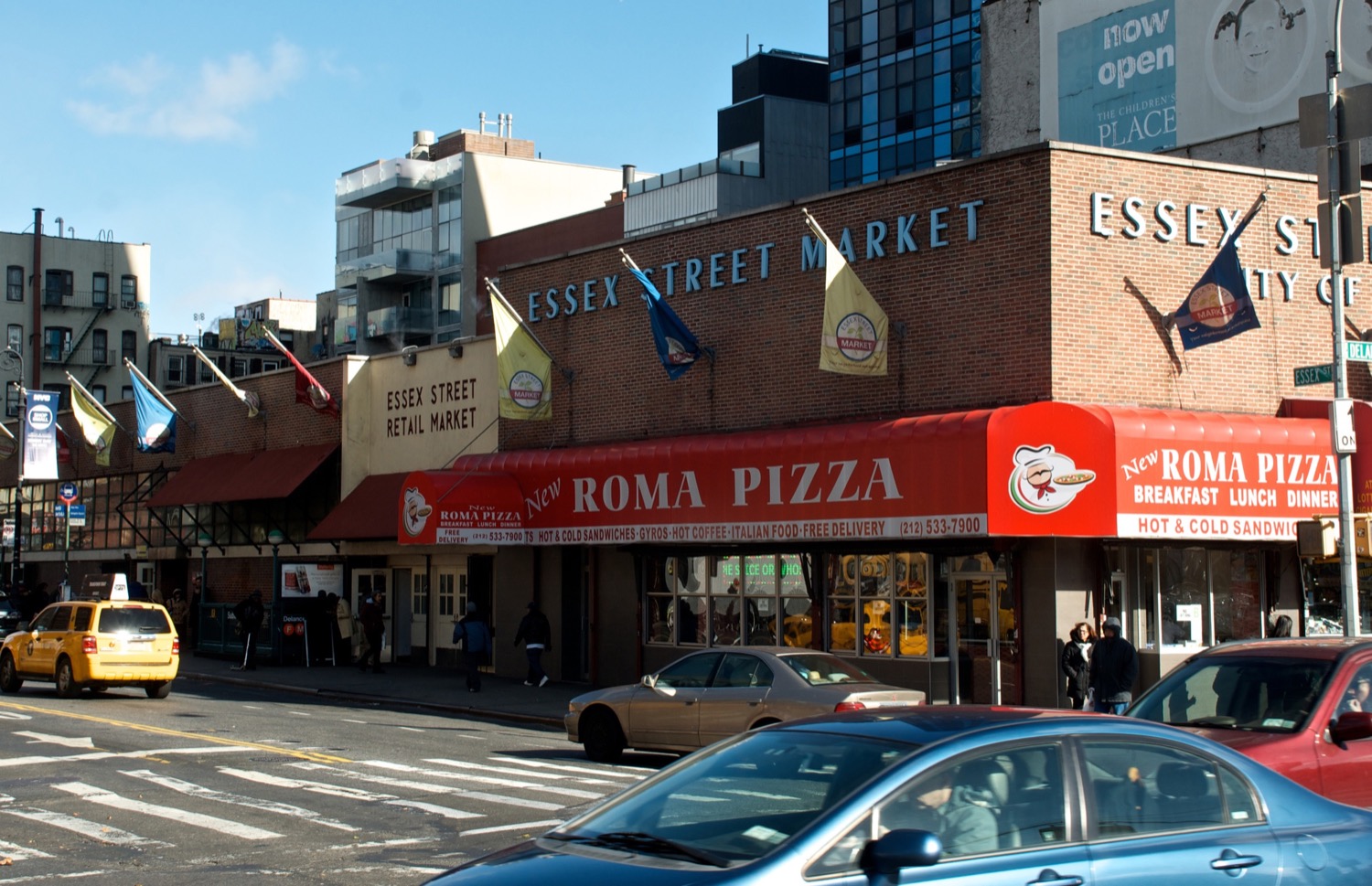
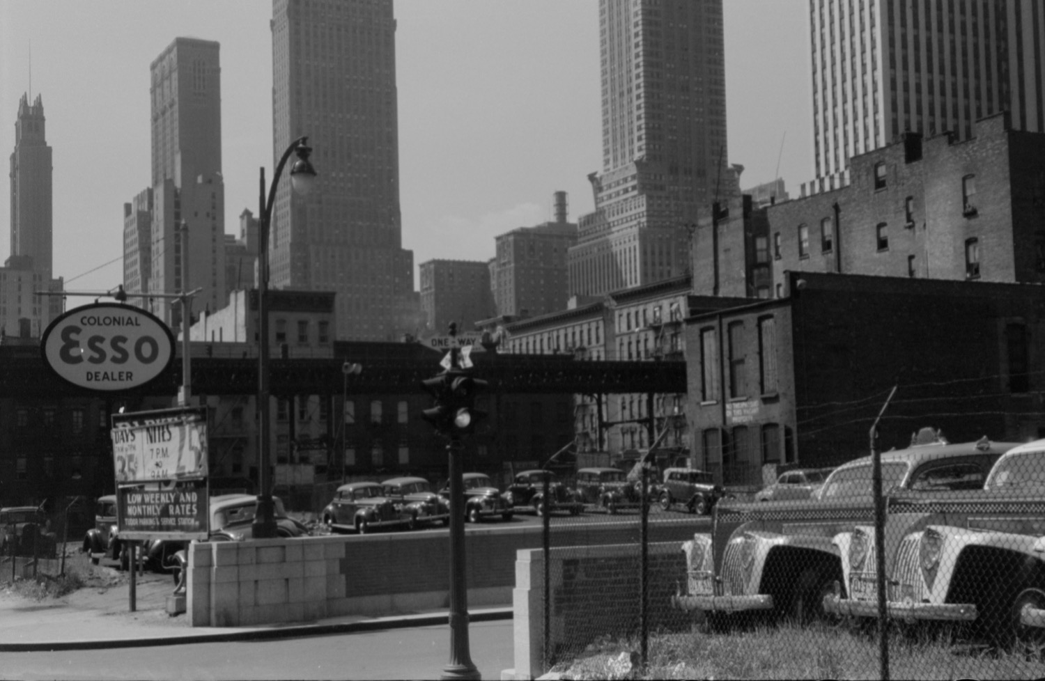
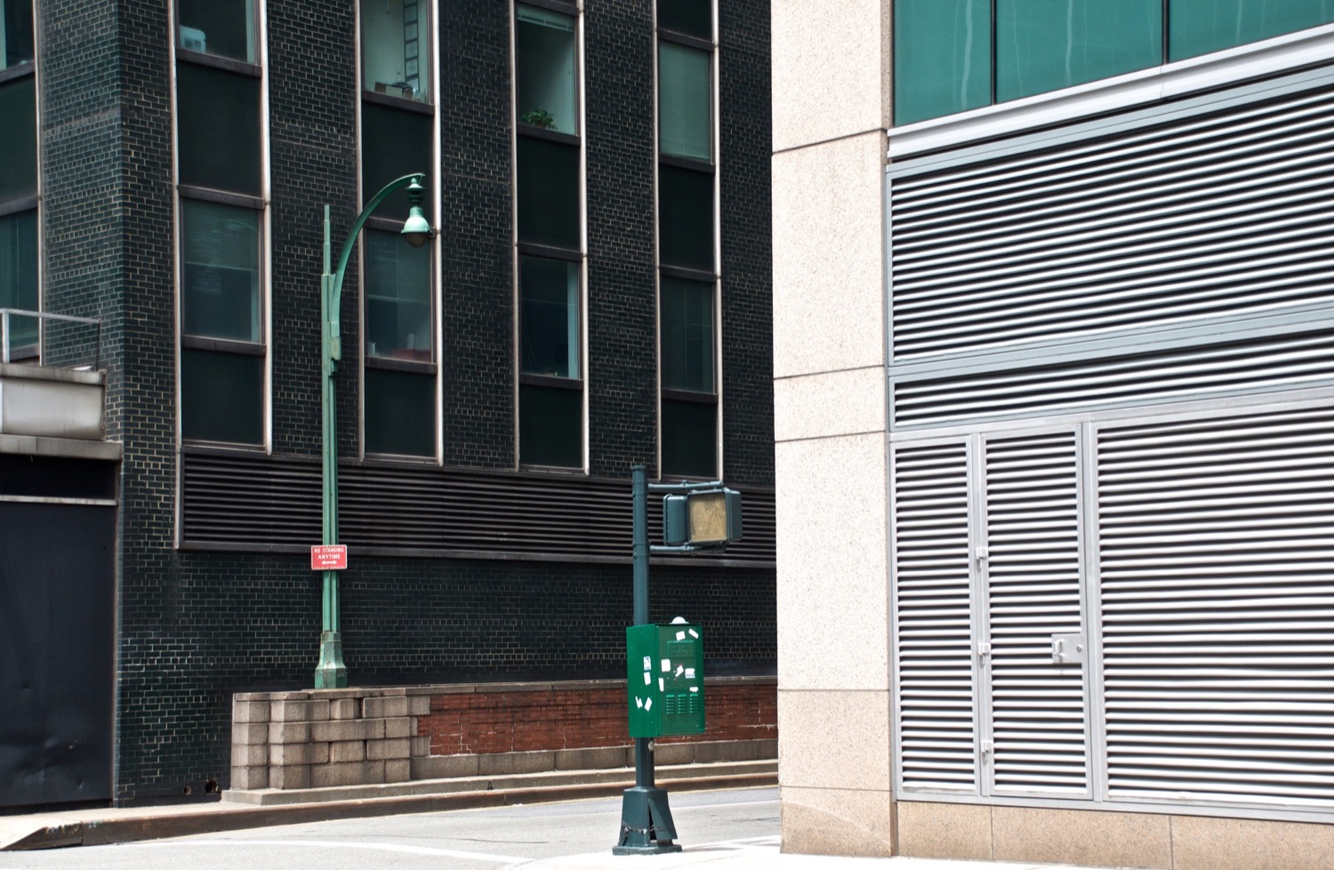
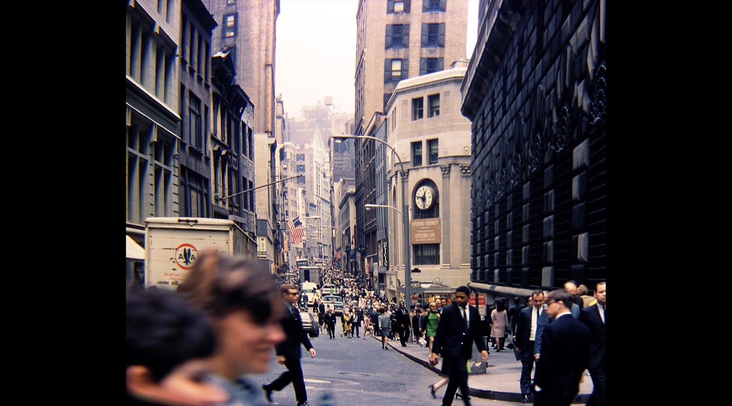
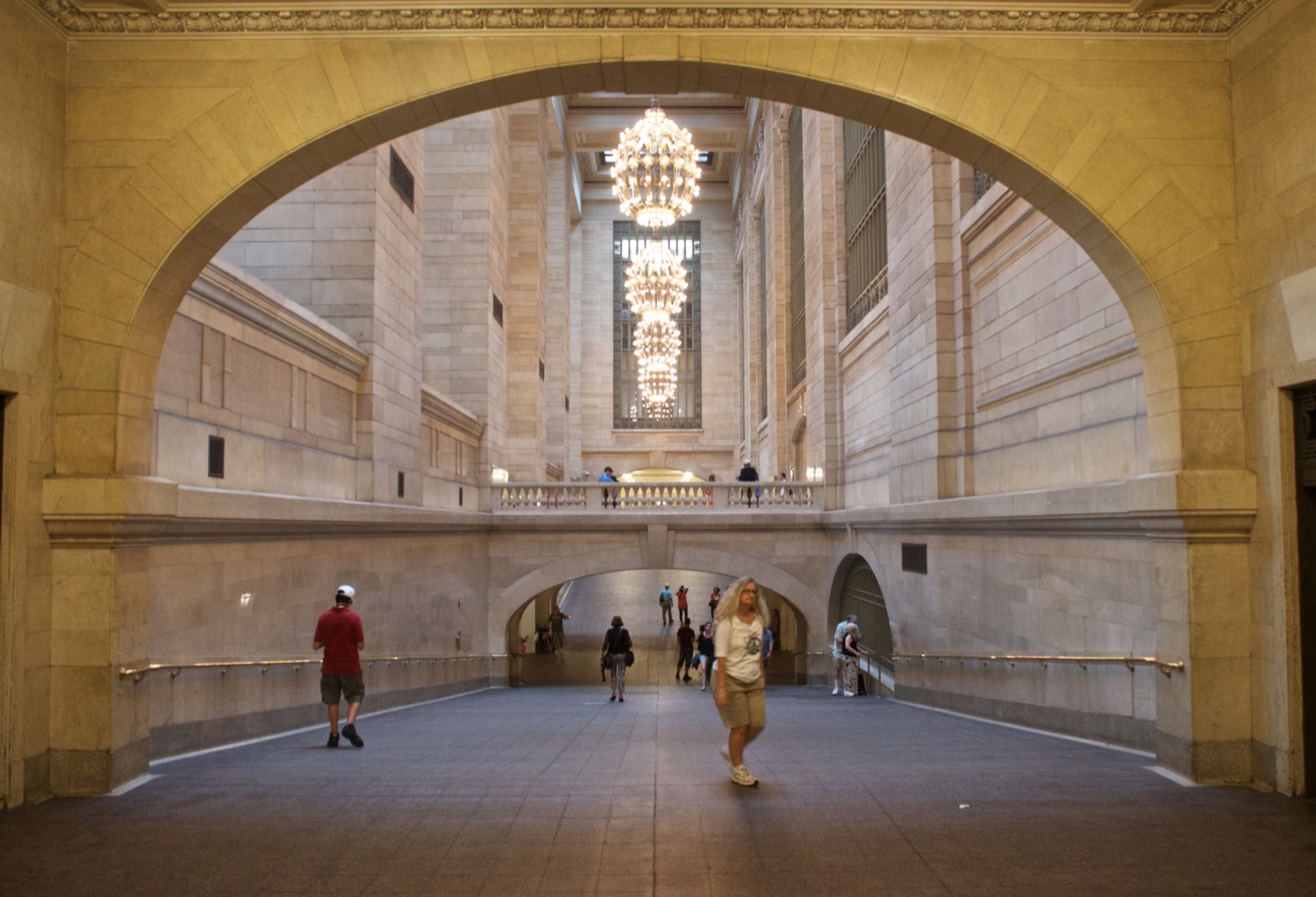
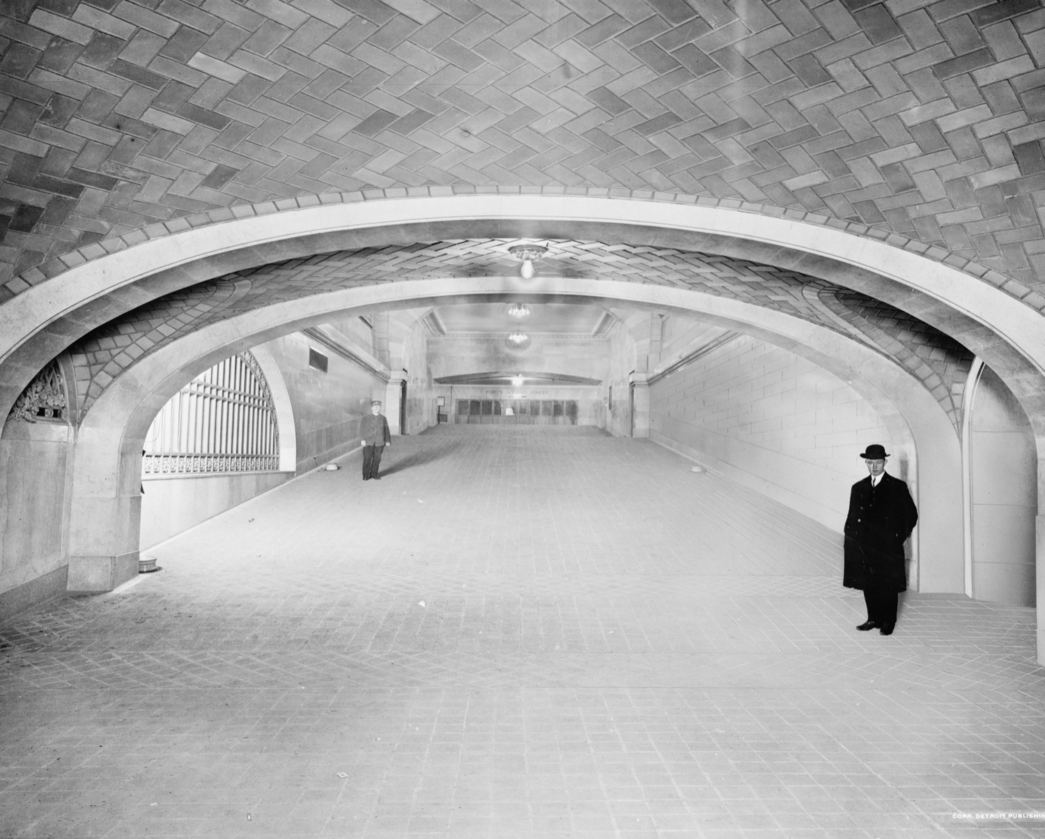
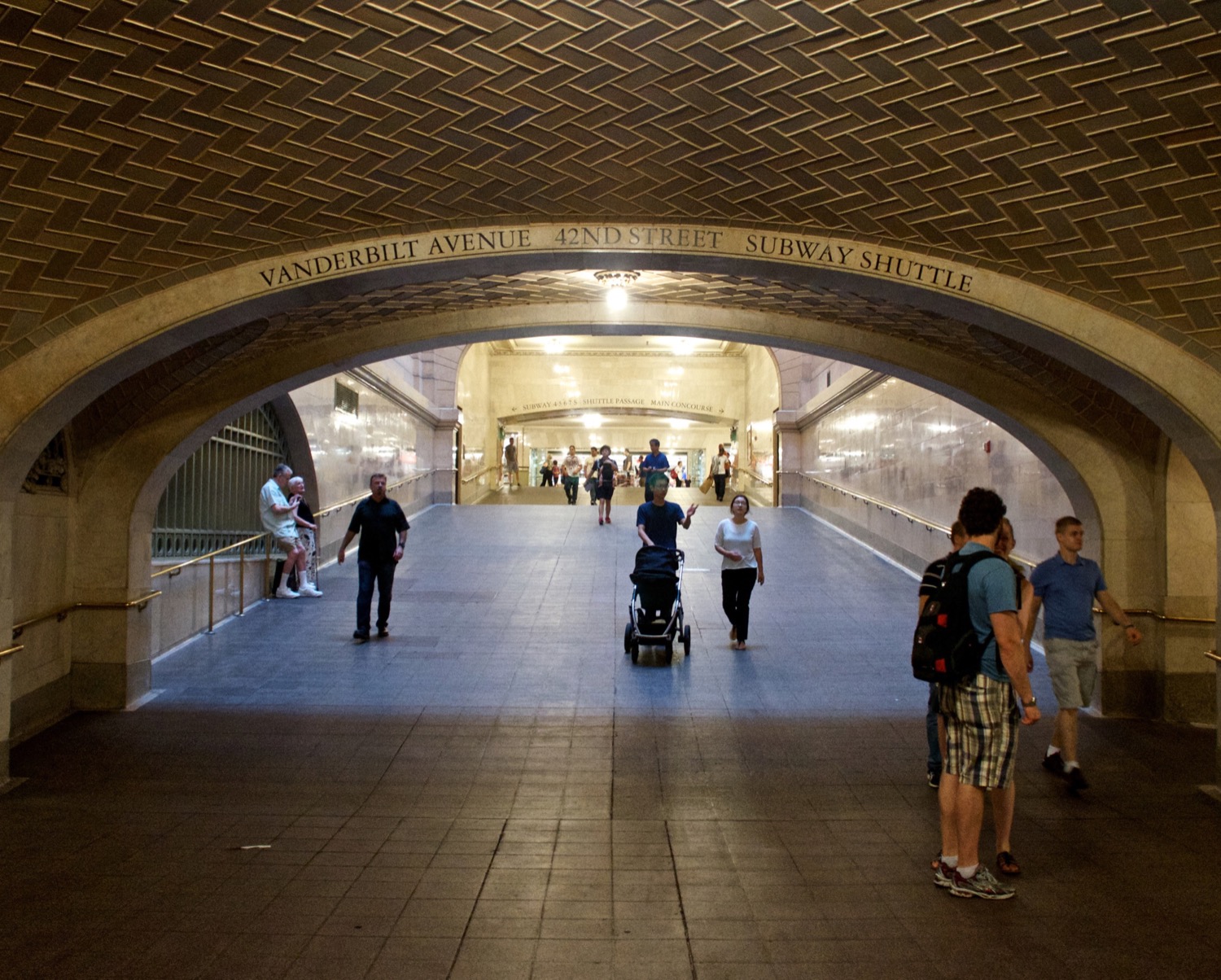
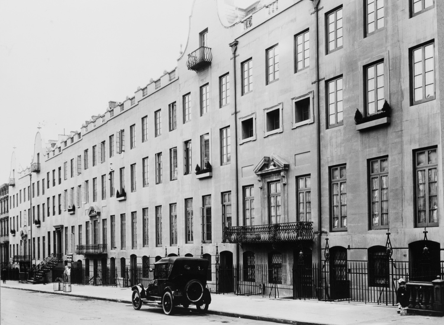
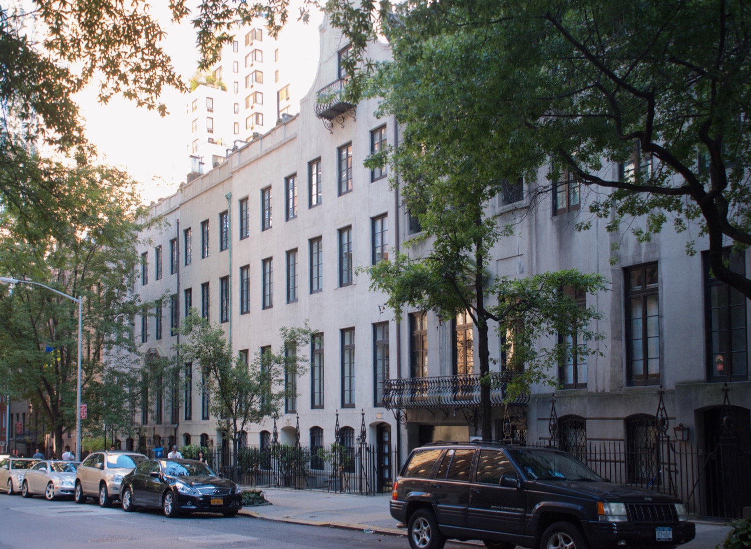
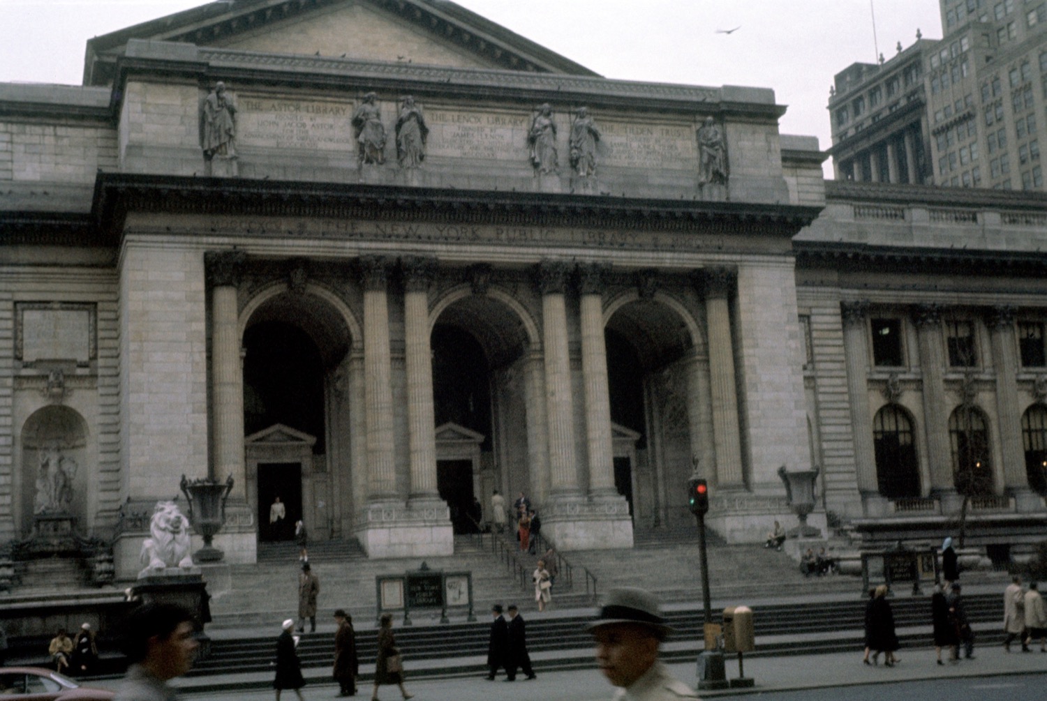
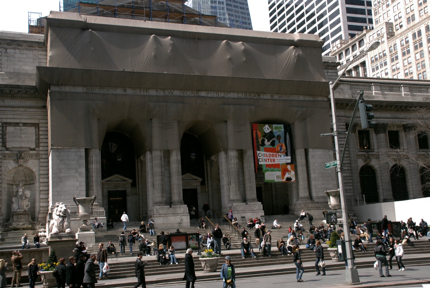
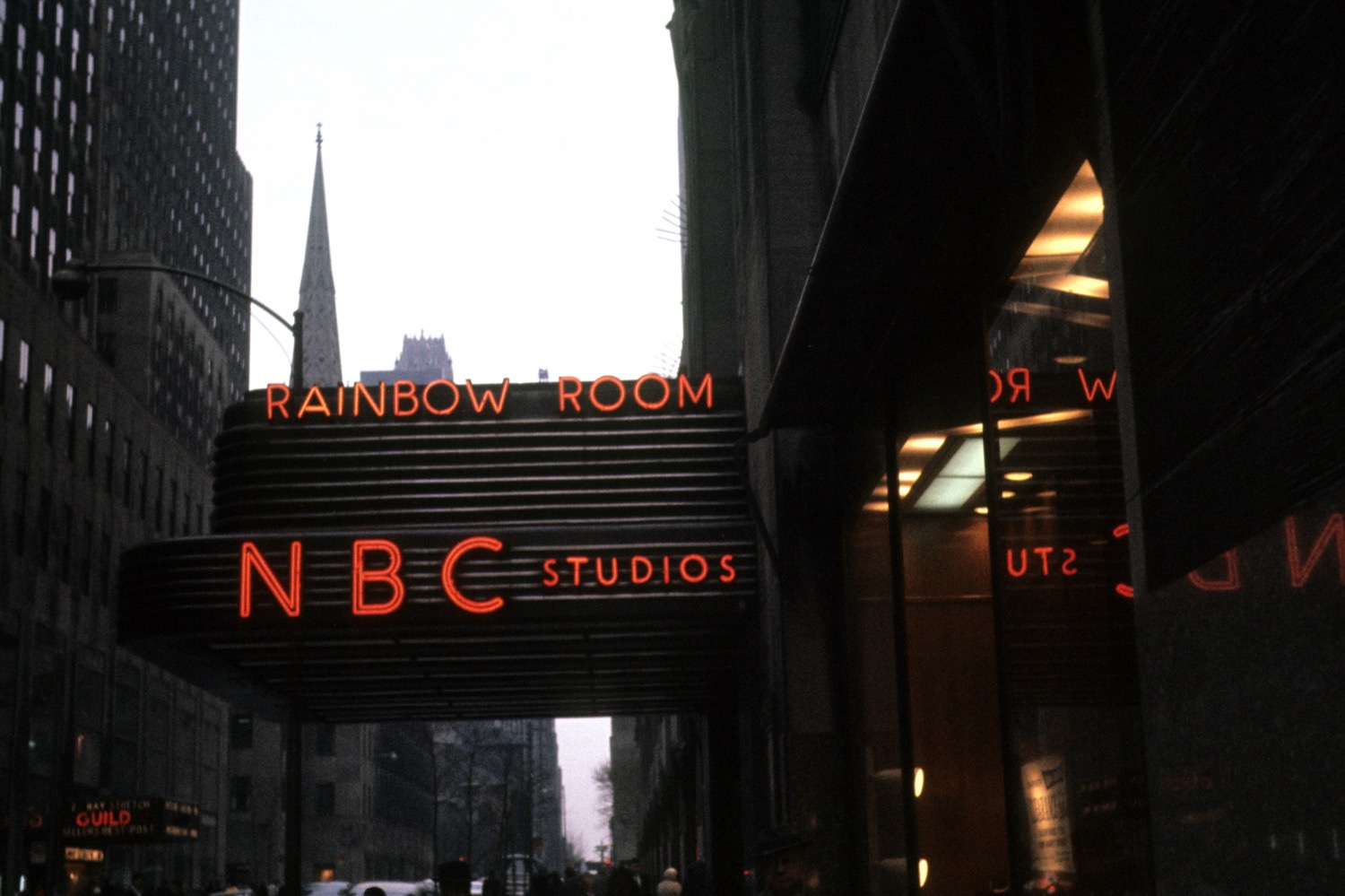
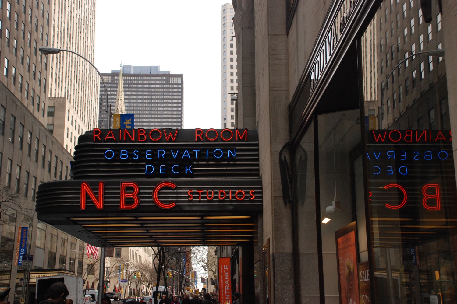
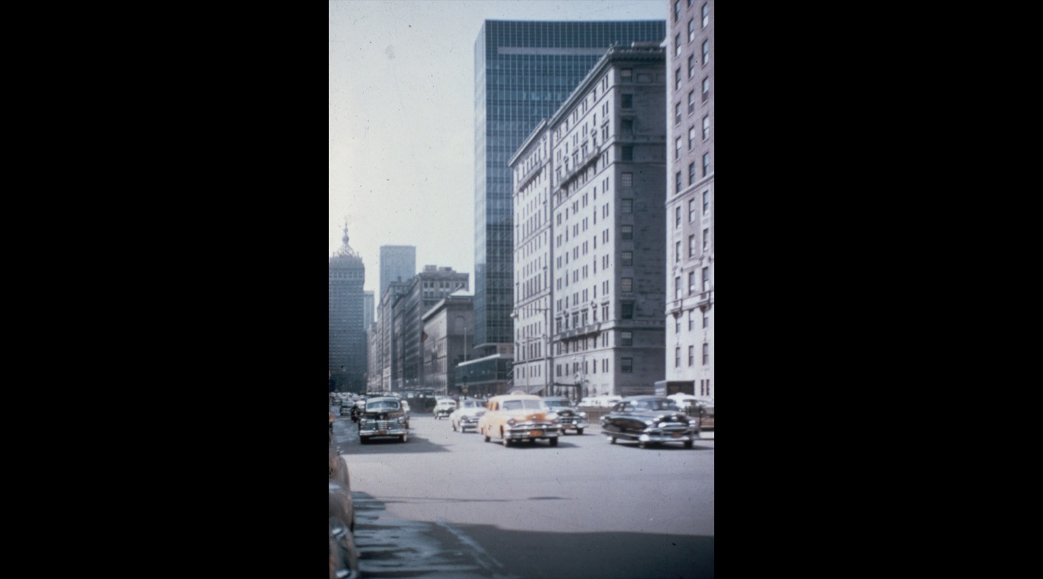
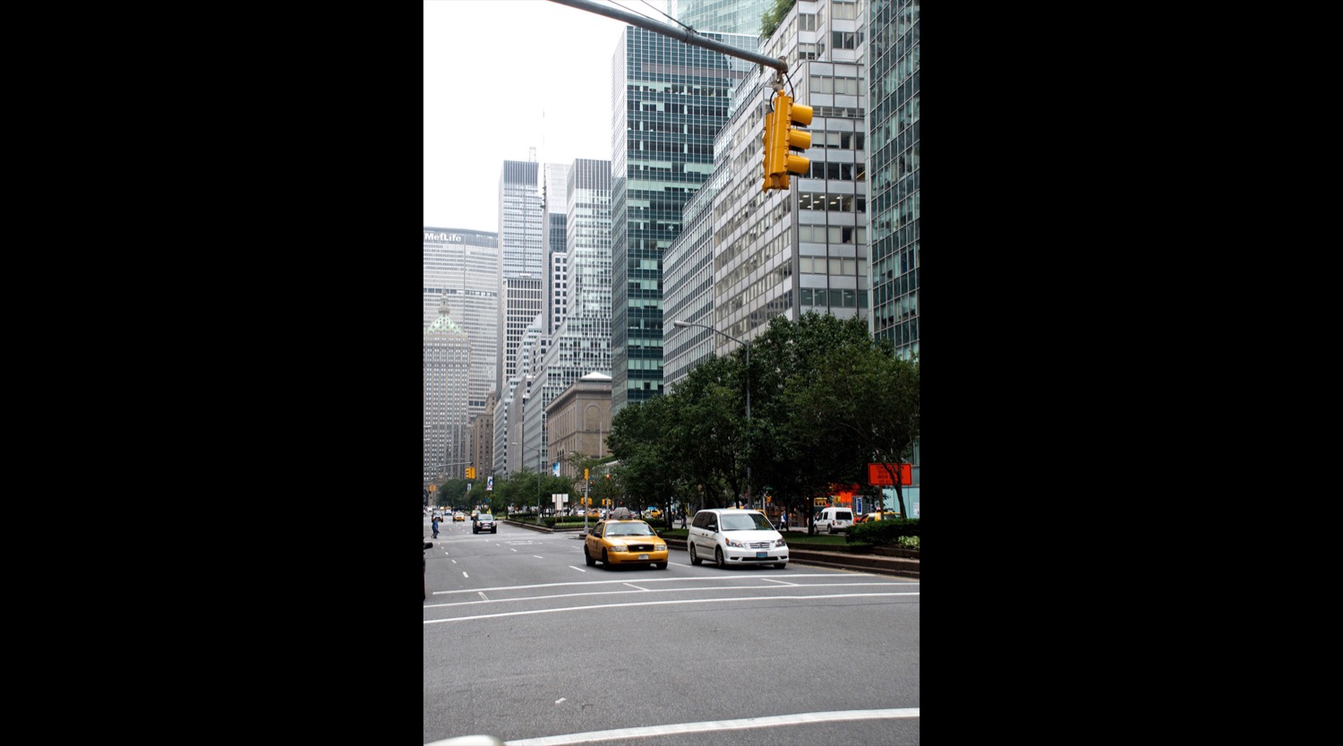
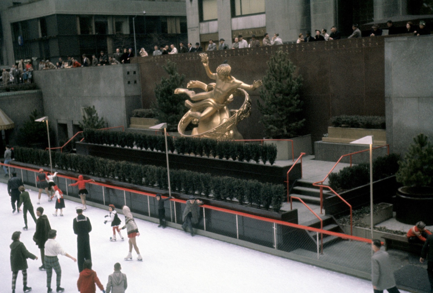
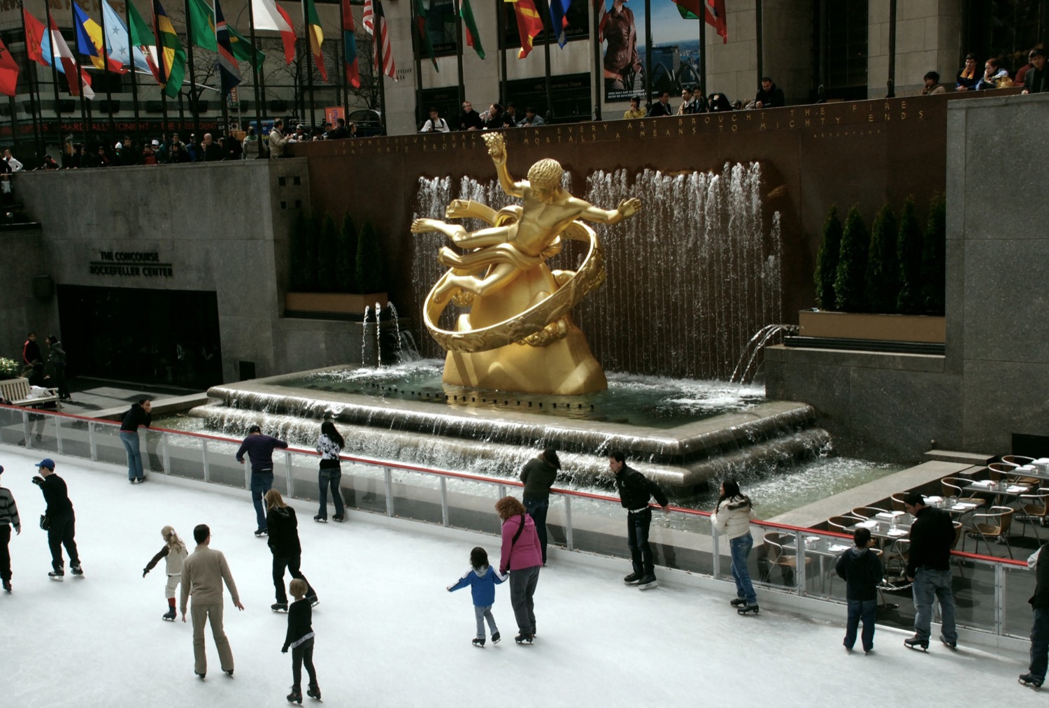
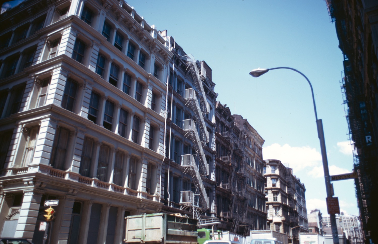
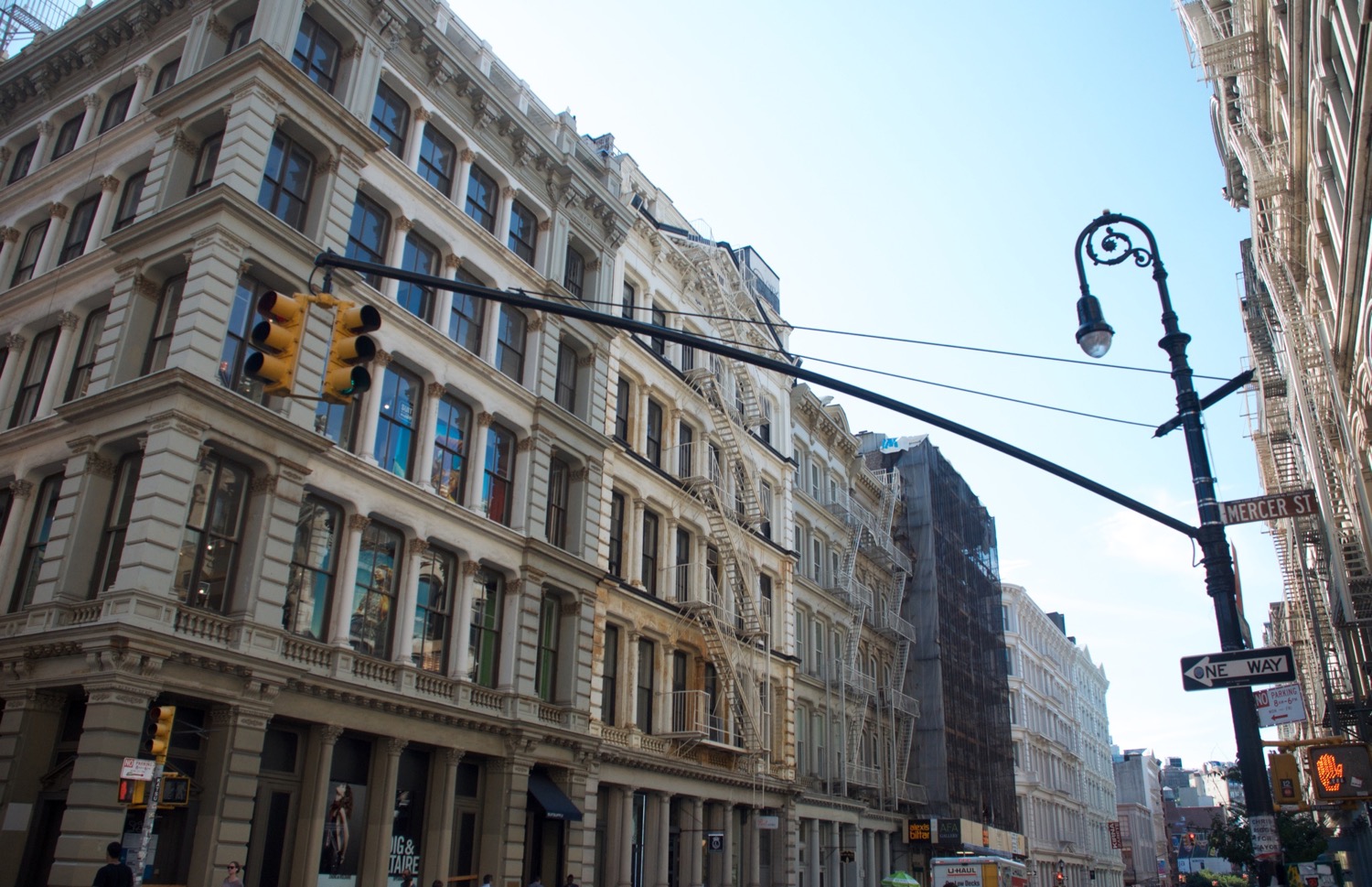
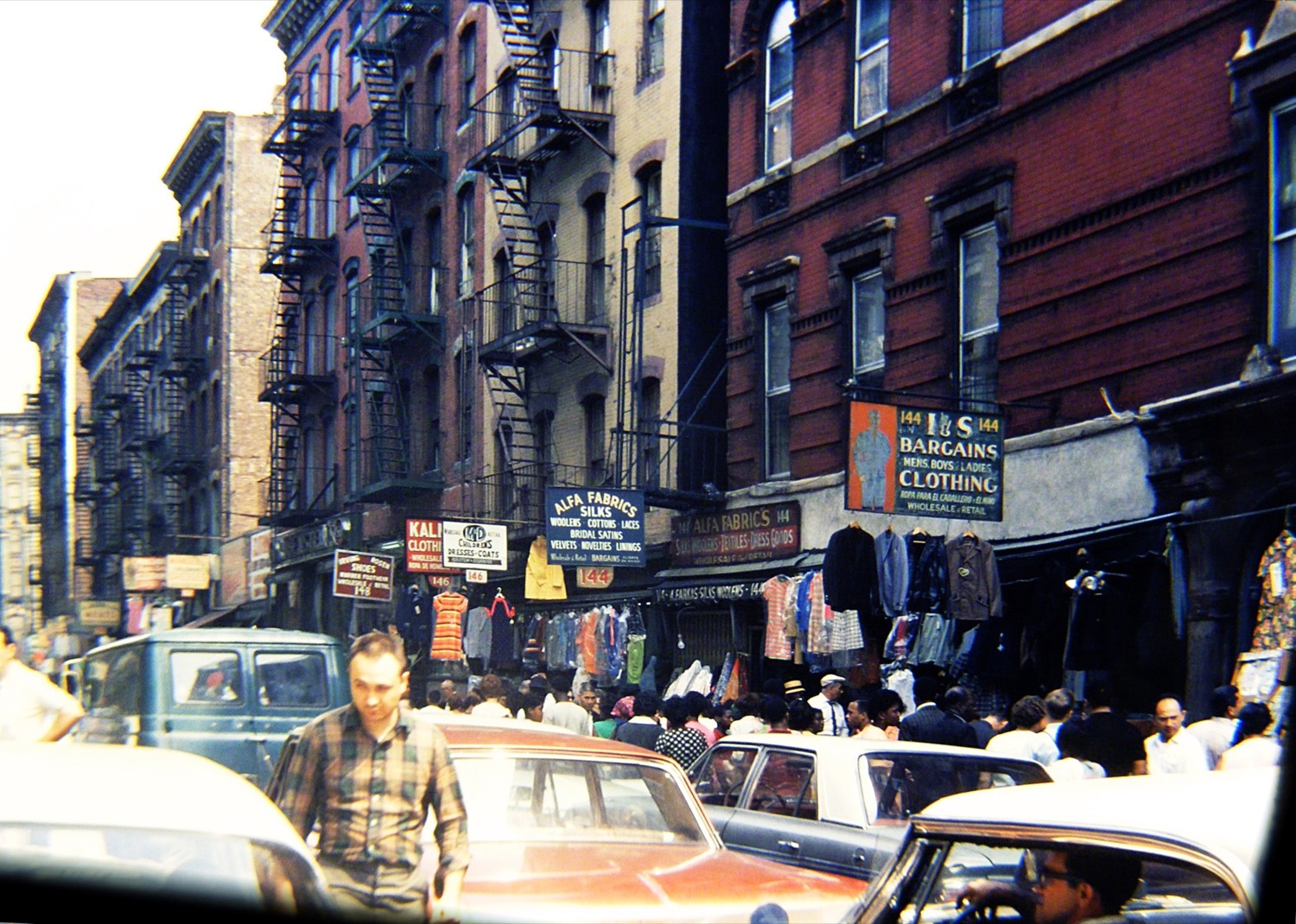
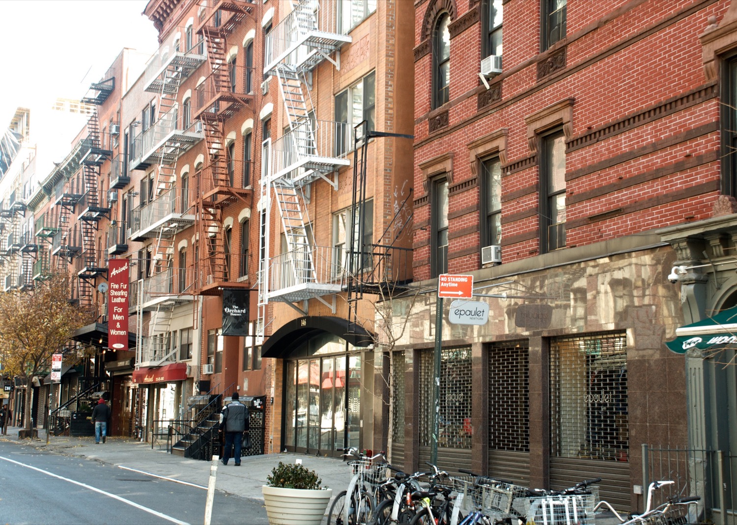
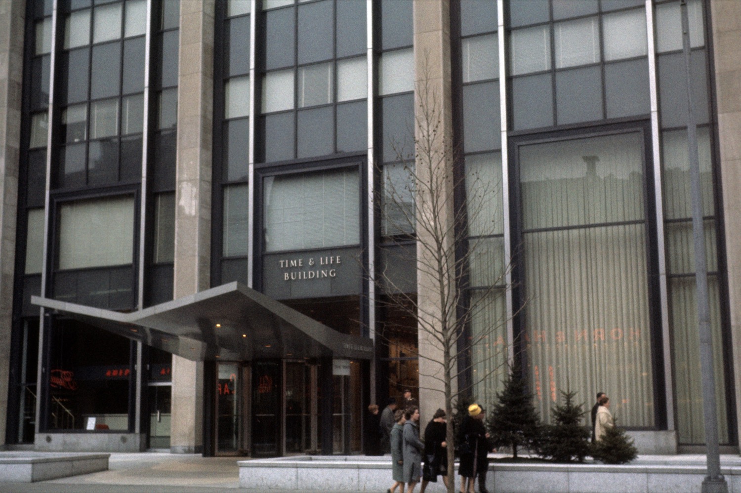
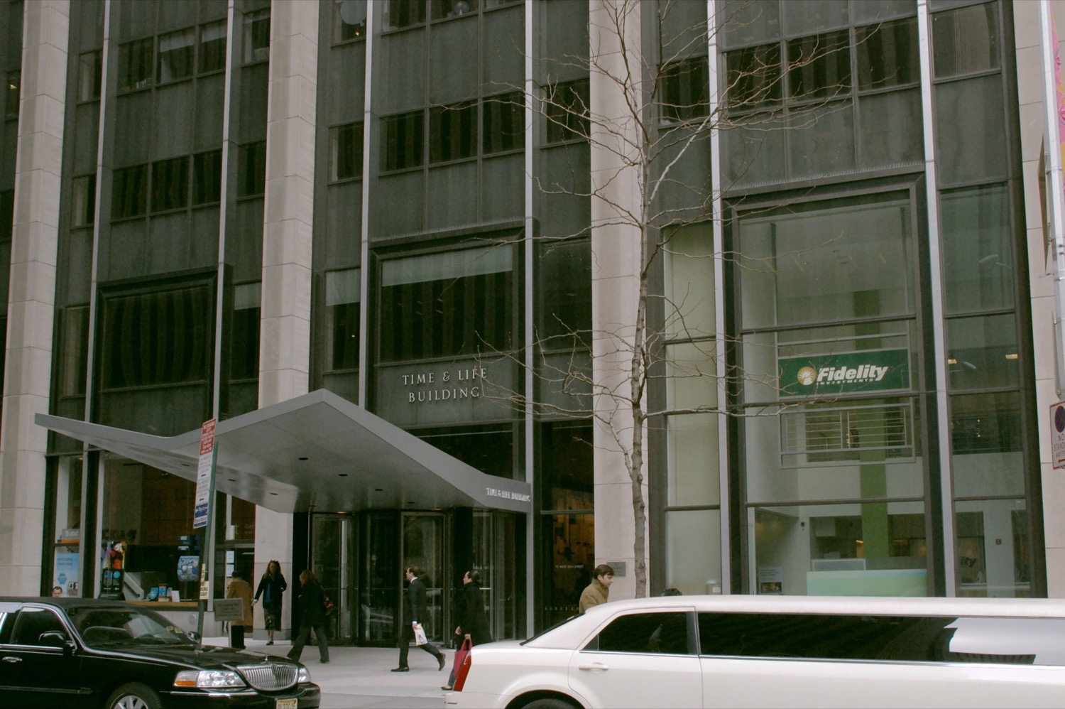
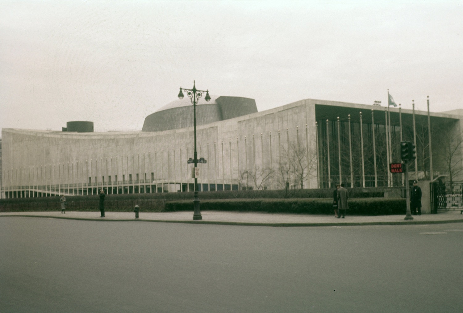
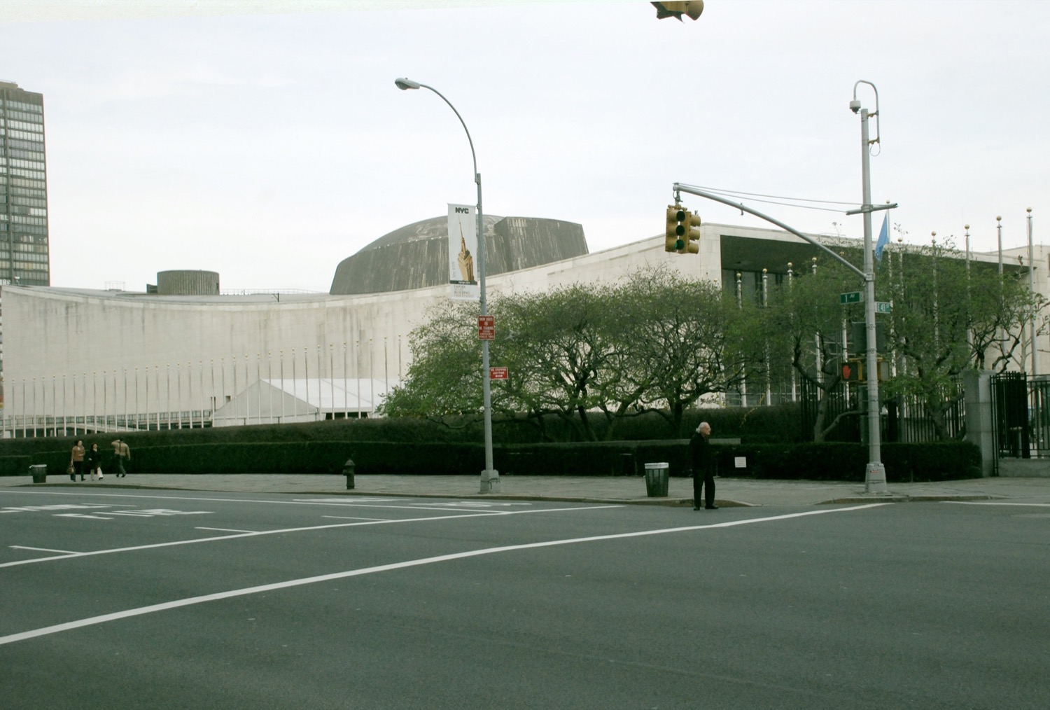
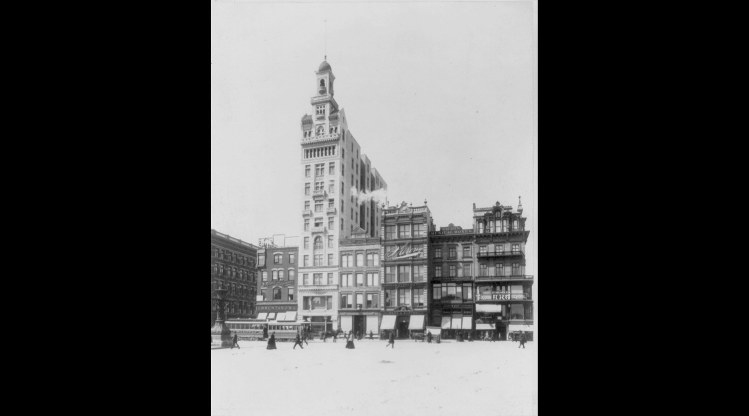
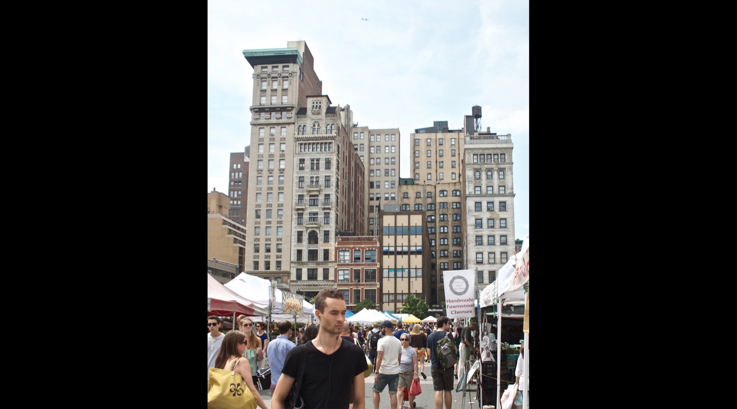
Starting with a collection of slides my grandfather shot in 1961 before eventually moving on to public domain photos; each location was thoroughly researched before I went on-site to recreate them as closely as possible.
The project got a lot of attention: During a period in 2013 the site saw nearly 100,000 unique visitors per day.
After moving away from New York, the project stagnated and I eventually closed the site down in 2018. However I thought it was a shame to not have these images available somewhere. So most of the original Before & After photos, complete with interactive slider, are embedded below.
For the versions posted on this page I went back to my original files, made some overdue adjustments and saved them at a much higher quality.